Area Overview for BS19 3DY
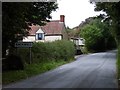
Photos of BS19 3DY


Area Information
Living in BS19 3DY, a small residential cluster in North Somerset, means inhabiting a village steeped in history and quiet charm. Nestled on the north slopes of the Mendip Hills, Wrington is a civil parish with a population of 1410, spread across 5,786 acres. Its low population density of 53 people per square kilometre reflects a rural, close-knit community. The village’s character is shaped by its medieval roots, including the 1400s Grade One listed Church of All Saints and the legacy of John Locke, the philosopher born here in 1632. Daily life here balances rural tranquillity with practical connectivity: three railway stations, two airports, and five ferry landings within reach. The absence of a main road through the village, a result of local protest, underscores a commitment to preserving its village feel. For those seeking a blend of historical significance and modern amenities, BS19 3DY offers a distinct alternative to urban living.
- Area Type
- Postcode
- Area Size
- Not available
- Population
- 1410
- Population Density
- 53 people/km²
The property market in BS19 3DY is characterised by high home ownership (86%) and a focus on houses, which dominate the housing stock. This suggests a community that values private, long-term residency over rental properties, with fewer apartments or flats. As a small, rural cluster, the area’s property landscape is likely limited in scale, with homes primarily serving local residents rather than commuters. The high proportion of owner-occupied houses may indicate a stable market with limited turnover, though buyers should consider the area’s small size and potential constraints on new development. For those seeking a family home with a strong sense of community, BS19 3DY offers a traditional, low-density alternative to larger urban centres.
House Prices in BS19 3DY
No properties found in this postcode.
Energy Efficiency in BS19 3DY
The lifestyle in BS19 3DY is shaped by its proximity to practical amenities, including five retail outlets such as Spar and The Southern Co-operative Co, which cater to daily shopping needs. The village’s historic character is complemented by its transport links, with ferry landings and railway stations providing access to nearby towns. While the data does not detail parks or leisure facilities, the absence of a main road and the presence of listed buildings suggest a focus on preserving local heritage. Residents can enjoy a mix of rural tranquillity and convenient connectivity, with nearby ferry services and rail networks offering flexibility for commuting or leisure trips. The area’s small size means amenities are closely grouped, fostering a sense of community.
Amenities
Schools
The nearest school to BS19 3DY is St Katharine’s Church of England Primary School, which serves the local community with primary education. While no secondary schools are listed in the data, the presence of a primary school suggests that families may need to look further afield for secondary education. The school’s religious affiliation and the lack of other educational institutions nearby could influence a family’s decision to reside in the area, depending on their preferences for school type and proximity to higher education. Parents should assess the availability of secondary schools and transport options to ensure their children’s long-term educational needs are met.
| Rank | School | Type | Entry gender | Ages |
|---|
Explore more schools in this area
Go to Schools tabDemographics
The community in BS19 3DY is predominantly composed of adults aged 30–64, with a median age of 47. This suggests a mature, stable population, likely with strong family ties and long-term residency. Home ownership is high, with 86% of residents living in owner-occupied properties, indicating a preference for settled, long-term housing. The accommodation type is largely houses, reflecting a traditional rural or semi-rural housing stock. The predominant ethnic group is White, with no data provided on other demographics. The low population density and high home ownership suggest a community focused on private, family-oriented living rather than transient rental markets. While specific deprivation data is not included, the absence of significant planning constraints or environmental risks points to a relatively stable quality of life for residents.
Household Size
Accommodation Type
Tenure
Ethnic Group
Religion
Household Composition
Age
Household Deprivation
NS-SEC
Explore more demographic insights in this area
Go to Demographics tabPlanning
Planning Constraints
- Flood RiskPremium
- Ramsar Wetland SitesPremium
- Area of Outstanding Natural BeautyPremium
- Protected Nature ReservePremium
- Protected WoodlandPremium