Area Overview for BS19 3DX
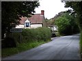
Photos of BS19 3DX


Area Information
BS19 3DX is a small postcode area encompassing the village of Wrington in North Somerset, a civil parish nestled on the north slopes of the Mendip Hills. With a population of 1,410 spread over 5,786 acres, the area retains a rural character, free from main roads due to a historic protest against a proposed turnpike. The village lies in the valley of the Congresbury Yeo river, 9 miles east of Weston-super-Mare and 3 miles south-east of Yatton. Its history dates back to 904 AD, with ties to Glastonbury Abbey and notable figures like John Locke, the philosopher born here in 1632. Daily life is shaped by its compact size, with a focus on local amenities, historic sites like the Grade I-listed Church of All Saints, and a community rooted in tradition. The area’s low population density and absence of major infrastructure make it distinct, offering a quiet, low-rise residential environment with a strong connection to the surrounding landscape.
- Area Type
- Postcode
- Area Size
- Not available
- Population
- 1410
- Population Density
- 53 people/km²
The property market in BS19 3DX is characterised by high home ownership (86%) and a predominance of houses over other property types. This suggests a largely owner-occupied area with limited rental activity, typical of smaller rural communities. The compact nature of the postcode, covering a single village, means the housing stock is concentrated within Wrington’s boundaries. With no major developments or high-density zones, properties here are likely to be traditional, often with garden spaces, reflecting the area’s rural setting. Buyers should consider the limited availability of properties, as the small population and low density may result in a slower-moving market. Proximity to nearby towns like Yatton and Weston-super-Mare could influence property values, but the absence of major transport links or urban amenities may appeal to those prioritising tranquility over convenience.
House Prices in BS19 3DX
No properties found in this postcode.
Energy Efficiency in BS19 3DX
Life in BS19 3DX is shaped by its proximity to local amenities, including five retail outlets such as Spar and The Southern Co-operative Co, which provide everyday shopping needs. The three railway stations offer access to nearby towns, while five ferry landings suggest opportunities for leisurely travel along the Congresbury Yeo river. The absence of a main road through the village preserves its historic charm, though this may limit through-traffic. The area’s small size means residents are likely to know their neighbours, fostering a close-knit community. While the village itself lacks large-scale entertainment or dining venues, nearby towns like Yatton and Weston-super-Mare likely provide additional options. The blend of local retail, transport links, and natural surroundings creates a lifestyle that prioritises convenience and connection to the environment.
Amenities
Schools
The nearest school to BS19 3DX is St Katharine’s Church of England Primary School, a primary institution serving the local community. While no Ofsted rating is provided in the data, the presence of a single primary school suggests that families in the area must rely on this single institution for early education. The lack of secondary schools nearby means students may need to travel to adjacent towns for further education. The school’s religious affiliation aligns with the village’s historical ties to the Church of England. For families, this represents both a convenience in having a local school and a potential limitation in terms of educational diversity. The absence of additional schools highlights the small scale of the area and its reliance on surrounding towns for comprehensive schooling.
| Rank | School | Type | Entry gender | Ages |
|---|
Explore more schools in this area
Go to Schools tabDemographics
The population of BS19 3DX has a median age of 47, with the majority of residents aged 30–64. Home ownership is high at 86%, reflecting a community where most properties are owner-occupied rather than rented. The area is predominantly composed of houses, with no significant presence of flats or other accommodation types. The predominant ethnic group is White, and the low population density of 53 people per square kilometre suggests a spread-out, rural settlement. The age profile indicates a mature demographic, which may influence local services and amenities. While specific data on deprivation is not provided, the high home ownership and stable age distribution suggest a relatively stable quality of life, though the lack of detailed socioeconomic metrics means broader implications remain unexplored.
Household Size
Accommodation Type
Tenure
Ethnic Group
Religion
Household Composition
Age
Household Deprivation
NS-SEC
Explore more demographic insights in this area
Go to Demographics tabPlanning
Planning Constraints
- Flood RiskPremium
- Ramsar Wetland SitesPremium
- Area of Outstanding Natural BeautyPremium
- Protected Nature ReservePremium
- Protected WoodlandPremium