Area Overview for BS19 3AX
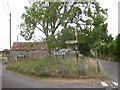
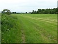
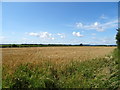
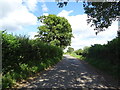
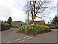
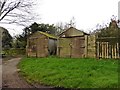
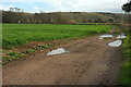
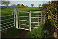
Photos of BS19 3AX
Area Information
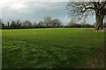
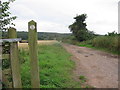
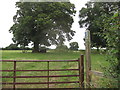
BS19 3AX is a small, tightly knit residential postcode in England, home to 1,584 people spread across a low-density area of 132 people per square kilometre. This cluster of homes reflects a mature, stable community, with a median age of 47 and a population dominated by adults aged 30–64. The area is defined by its modest scale and quiet suburban character, offering a contrast to larger urban centres. Daily life here is shaped by proximity to essential services, including two railway stations, retail outlets, and nearby airports. The absence of major environmental constraints—no flood zones, protected woodlands, or conservation areas—means residents enjoy a straightforward, unencumbered living experience. With 82% of homes owned outright, the area leans towards long-term residency rather than transient tenancy, fostering a sense of continuity. Its small size means the community is closely connected, with local amenities and transport links serving the immediate needs of residents. For those seeking a peaceful, low-maintenance lifestyle with practical infrastructure, BS19 3AX offers a compelling blend of accessibility and tranquillity.
- Area Type
- Postcode
- Area Size
- Not available
- Population
- 1584
- Population Density
- 132 people/km²
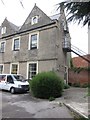
The property market in BS19 3AX is characterised by high home ownership—82% of properties are owner-occupied—suggesting a community of long-term residents rather than a transient rental market. The accommodation type is predominantly houses, which implies a focus on standalone, family-friendly homes. Given the area’s small size and low population density, the housing stock is limited, meaning buyers may find fewer options but potentially more established properties. The absence of planning constraints or environmental restrictions—such as protected woodlands or flood zones—means development is unlikely to disrupt the existing character of the area. For buyers, this translates to a market where properties are likely to retain value due to their scarcity and the area’s stability. However, the small scale of the postcode means that proximity to nearby towns and amenities is crucial, with transport links playing a key role in accessibility for residents.
House Prices in BS19 3AX
No properties found in this postcode.
Energy Efficiency in BS19 3AX
Living in BS19 3AX offers a mix of practical amenities within easy reach. Five retail outlets, including Budgens Cleeve and The Southern Co-operative, provide everyday shopping convenience. The two railway stations and nearby airports ensure reliable transport links, while Clevedon Pier offers a scenic ferry option for leisure. The area’s low crime rate and lack of environmental constraints contribute to a safe, untroubled lifestyle. Though the data lists no parks or recreational spaces explicitly, the absence of planning restrictions suggests open spaces may be accessible nearby. The small scale of the postcode means amenities are concentrated, reducing the need for long commutes. For residents, this balance of practicality and accessibility supports a lifestyle that prioritises ease and security without sacrificing connection to broader regional networks.
Amenities
Schools
The nearest school to BS19 3AX is Fairfield PNEU School, an independent institution. While no Ofsted rating is provided, the presence of a private school suggests the area may attract families seeking alternative educational options. The limited number of schools in the vicinity means parents should consider the broader local education landscape for additional choices. For those prioritising independent schooling, Fairfield PNEU School offers a dedicated option, though families may need to look beyond the immediate postcode for state-funded alternatives. The absence of other schools listed in the data indicates that the area’s educational infrastructure is relatively sparse, requiring careful planning for commuting or additional schooling needs.
| Rank | School | Type | Entry gender | Ages |
|---|
Explore more schools in this area
Go to Schools tabDemographics
The community in BS19 3AX is predominantly composed of adults aged 30–64, with a median age of 47. This suggests a mature, stable population with a strong likelihood of long-term residency. Home ownership is high at 82%, indicating a preference for settled living over rental tenancies. The area’s housing stock is primarily composed of individual homes, reflecting a traditional, family-oriented demographic. The predominant ethnic group is White, which aligns with broader regional patterns. With a population density of 132 people per square kilometre, the area avoids the overcrowding and anonymity of denser urban zones, contributing to a more personal, neighbourly atmosphere. The absence of specific deprivation data means the quality of life here is likely shaped by the community’s self-sufficiency, with residents benefiting from the area’s low crime rate and minimal environmental risks. This makes BS19 3AX a place where established residents can enjoy a predictable, secure lifestyle.
Household Size
Accommodation Type
Tenure
Ethnic Group
Religion
Household Composition
Age
Household Deprivation
NS-SEC
Explore more demographic insights in this area
Go to Demographics tabPlanning
Planning Constraints
- Flood RiskPremium
- Ramsar Wetland SitesPremium
- Area of Outstanding Natural BeautyPremium
- Protected Nature ReservePremium
- Protected WoodlandPremium