Area Overview for BS19 2FX
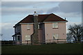
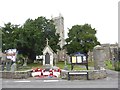
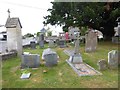
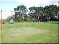
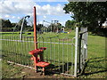
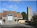
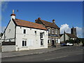
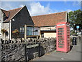
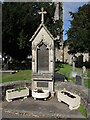
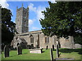
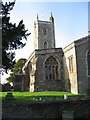
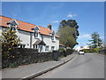
Photos of BS19 2FX
Area Information
BS19 2FX is a small residential postcode area within the market town of Nailsea, North Somerset. With a population of 1,472, it reflects the character of a tight-knit community nestled approximately 8 miles southwest of Bristol and 11 miles northeast of Weston-super-Mare. Historically shaped by coal mining and glassworks, the area now balances heritage with modern living. The Coates Estate, a former cider factory turned business hub, adds to the town’s contemporary appeal. Residents benefit from proximity to natural and cultural landmarks, including Tyntesfield National Trust property. The area’s compact size means amenities are within practical reach, while its location offers easy access to larger cities and coastal towns. Daily life here is defined by a mix of traditional architecture, local businesses, and a community rooted in history yet oriented toward practicality. For those seeking a quieter alternative to urban centres, BS19 2FX offers a blend of stability and accessibility.
- Area Type
- Postcode
- Area Size
- Not available
- Population
- Not available
- Population Density
- Not available
BS19 2FX is predominantly an owner-occupied area, with 77% of homes owned by residents rather than rented. The accommodation type is largely houses, which is typical of smaller, suburban postcodes. This suggests a housing stock focused on family homes, likely with gardens and more space than apartments. Given the area’s small size, the property market is limited to a handful of homes, meaning buyers may need to consider nearby areas for more options. The high home ownership rate indicates a stable market with long-term residents, reducing turnover. For buyers, this implies a potential for value retention, though competition for available properties may be fierce. The presence of houses also aligns with a preference for private, low-density living, appealing to those seeking space and privacy.
House Prices in BS19 2FX
No properties found in this postcode.
Energy Efficiency in BS19 2FX
Residents of BS19 2FX have access to a range of amenities within walking or short driving distance. Retail options include The Southern Co-operative, Iceland Nailsea, and Waitrose Nailsea, providing everyday shopping needs. Rail stations like Nailsea & Backwell and Portway Park & Ride offer links to major cities, while Bristol Airport is within reach for travel. Ferries to Clevedon Pier and Portishead Pier add leisure options, and nearby Tyntesfield National Trust property offers historical and natural attractions. The area’s small size ensures convenience, with local businesses and services clustered closely. This mix of retail, transport, and leisure facilities supports a balanced lifestyle, blending practicality with access to cultural and recreational opportunities.
Amenities
Schools
Nearby schools include Grove Junior School and Hannah More Infant School, both operating as primary schools and academies. While no Ofsted ratings are provided, the presence of two institutions with the same names suggests a focus on primary education, possibly serving different age groups or offering distinct curricula. The mix of traditional and academy school models may provide families with choice, though the lack of specific performance data means outcomes cannot be assessed. For parents, the proximity of these schools is a key factor, ensuring children have access to local education without long commutes. The absence of secondary schools in the immediate area may require families to consider nearby towns for further education, but the primary options available are likely sufficient for younger children.
| Rank | School | Type | Entry gender | Ages |
|---|
Explore more schools in this area
Go to Schools tabDemographics
The median age in BS19 2FX is 47, with the majority of residents aged 30–64. This suggests a mature, established community, likely with strong family ties and a focus on long-term living. Home ownership is high at 77%, indicating a preference for settled, owner-occupied properties. The predominant accommodation type is houses, reflecting a suburban or semi-rural character. The predominant ethnic group is White, though no data is provided on other demographics. The absence of specific deprivation statistics means the area’s socioeconomic profile remains unquantified, but the high home ownership rate and age distribution suggest a relatively stable, middle-income population. This demographic profile aligns with a community prioritising security, family-oriented living, and proximity to essential services.
Household Size
Accommodation Type
Tenure
Ethnic Group
Religion
Household Composition
Age
Household Deprivation
NS-SEC
Explore more demographic insights in this area
Go to Demographics tabPlanning
Planning Constraints
- Flood RiskPremium
- Ramsar Wetland SitesPremium
- Area of Outstanding Natural BeautyPremium
- Protected Nature ReservePremium
- Protected WoodlandPremium