Area Overview for BS19 2FR
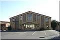
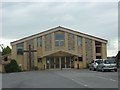
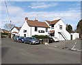
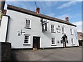
Photos of BS19 2FR
Area Information
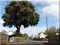
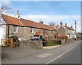
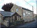
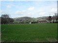
BS19 2FR is a small, tightly knit residential postcode area in North Somerset, England, encompassing parts of Nailsea, a market town with a rich industrial heritage. The area’s population of 1,630 reflects its compact nature, typical of a rural cluster with a focus on housing rather than commercial activity. Nailsea itself lies 8 miles southwest of Bristol and 11 miles northeast of Weston-super-Mare, placing it at the crossroads of regional connectivity. Historically shaped by coal mining and glassworks, the town now balances its industrial past with modern amenities. The Coates Estate, once a cider factory, now hosts diverse businesses, while nearby Tyntesfield National Trust property offers a touch of historical grandeur. Daily life here is defined by proximity to nature, with visible remnants of old coal pits and historic churches like Holy Trinity, dating to the 14th–15th centuries. The area’s small size and low population density suggest a quiet, community-oriented lifestyle, ideal for those seeking a slower pace without sacrificing access to regional infrastructure.
- Area Type
- Postcode
- Area Size
- Not available
- Population
- Not available
- Population Density
- Not available
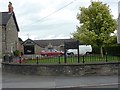
The property market in BS19 2FR is dominated by owner-occupied homes, with 85% of residents living in properties they own. This high rate of home ownership indicates a stable, low-rental market, where properties are likely to be family homes rather than short-term investments. The accommodation type is primarily houses, which is unusual for a small postcode area and suggests a mix of detached and semi-detached housing. This configuration may limit the availability of flats or apartments, making the area more appealing to buyers seeking traditional family homes. The small size of the postcode and its focus on residential clusters mean that property choices are limited to the immediate vicinity, requiring buyers to consider nearby areas for more options. The combination of high home ownership and a house-dominated market implies a conservative, long-term outlook among residents, with properties likely to hold value over time.
House Prices in BS19 2FR
No properties found in this postcode.
Energy Efficiency in BS19 2FR
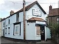
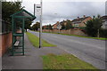
Living in BS19 2FR offers a blend of convenience and accessibility, with nearby amenities that cater to daily needs. The retail sector includes five notable stores such as The Southern Co-operative Co, Iceland Nailsea, and Waitrose Nailsea, ensuring a range of shopping options. Rail stations like Nailsea & Backwell and Portway Park & Ride provide easy access to Bristol and surrounding areas, while proximity to Bristol Airport facilitates travel. Ferry services at Clevedon Pier and Portishead Pier add to the area’s appeal for leisure activities. The presence of historic sites like Holy Trinity Church and Tyntesfield National Trust property enriches the cultural landscape. This combination of retail, transport, and historical attractions creates a lifestyle that balances practicality with a touch of heritage, making it suitable for those who value both convenience and a connection to the past.
Amenities
Schools
| Rank | School | Type | Entry gender | Ages |
|---|
Explore more schools in this area
Go to Schools tabDemographics
The population of BS19 2FR is predominantly middle-aged, with a median age of 47 and the majority of residents falling within the 30–64 age range. This suggests a stable, established community with strong family ties. Home ownership is exceptionally high at 85%, indicating a preference for long-term residency over rental properties. The accommodation type is primarily houses, reflecting a suburban or semi-rural character rather than high-density housing. The predominant ethnic group is White, aligning with broader regional demographics. This demographic profile implies a mature, settled population with lower turnover rates. The absence of specific data on deprivation levels means no direct commentary on socioeconomic challenges, but the high home ownership and age distribution suggest a community with relative financial stability and a focus on long-term investment in property.
Household Size
Accommodation Type
Tenure
Ethnic Group
Religion
Household Composition
Age
Household Deprivation
NS-SEC
Explore more demographic insights in this area
Go to Demographics tabPlanning
Planning Constraints
- Flood RiskPremium
- Ramsar Wetland SitesPremium
- Area of Outstanding Natural BeautyPremium
- Protected Nature ReservePremium
- Protected WoodlandPremium