Area Overview for BS19 2FF
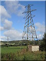
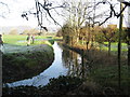
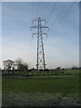
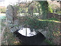
Photos of BS19 2FF

Area Information
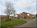
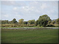
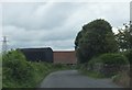
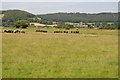
BS19 2FF is a small residential cluster in North Somerset, England, encompassing the historic market town of Nailsea. With a population of 1,542 and a high density of 1,486 people per square kilometre, this area reflects a compact, tightly knit community. Nestled 8 miles southwest of Bristol and 11 miles northeast of Weston-super-Mare, Nailsea’s name may derive from Old English, meaning “Naegl’s island.” The town has roots in Roman times, though its industrial identity emerged in the 18th century through coal mining and glassworks. Today, it balances historical heritage with modern amenities. Residents benefit from proximity to nearby attractions such as Tyntesfield National Trust property and the Coates Estate, a former cider factory now housing diverse businesses. The area’s character is shaped by its market town status, with a focus on retail, transport links, and community institutions. Daily life here is influenced by its strategic location, offering access to rail, ferry, and airport services, while retaining a distinct local identity rooted in its past.
- Area Type
- Postcode
- Area Size
- Not available
- Population
- 1542
- Population Density
- 1486 people/km²
The property market in BS19 2FF is dominated by owner-occupied homes, with 68% of properties owned by residents rather than rented. This high home ownership rate indicates a stable market with long-term residents, reducing the likelihood of frequent turnover. The predominant accommodation type is houses, which aligns with the area’s character as a small market town. This suggests a housing stock that is largely traditional, with fewer high-density developments. For buyers, this means a focus on family homes and semi-detached properties, which are typical in such settings. The small size of the postcode area implies that properties are closely spaced, and the immediate surroundings likely offer similar housing types. While the data does not specify property prices or recent trends, the combination of high ownership and house-centric stock suggests a market that may appeal to those seeking a settled, community-focused lifestyle rather than investment opportunities.
House Prices in BS19 2FF
No properties found in this postcode.
Energy Efficiency in BS19 2FF
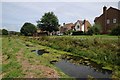
Living in BS19 2FF offers access to a range of amenities within practical reach. Retail options include The Southern Co-operative Co, Iceland Nailsea, and Waitrose Nailsea, providing essential shopping and grocery needs. The area’s rail network, with stations like Nailsea & Backwell and Portway Park & Ride, connects residents to nearby towns and cities. Ferry services at Clevedon Pier and Portishead Pier add convenience for coastal travel. While the data does not specify dining or leisure venues, the presence of multiple churches, historical sites like Holy Trinity Church, and the Coates Estate suggests a mix of cultural and commercial activity. The town’s market town status implies a central hub for local services, though the exact character of its high street or community spaces is not detailed. The combination of retail, transport, and nearby attractions creates a lifestyle that balances practicality with access to regional amenities.
Amenities
Schools
| Rank | School | Type | Entry gender | Ages |
|---|
Explore more schools in this area
Go to Schools tabDemographics
The population of BS19 2FF has a median age of 47, with the majority of residents aged between 30 and 64. This suggests a community skewed toward middle-aged adults, likely including families and professionals. Home ownership is high at 68%, indicating a stable, long-term resident base. The predominant accommodation type is houses, reflecting a residential area with a focus on family homes rather than flats or apartments. The predominant ethnic group is White, with no specific data on other demographics. The absence of detailed diversity statistics means the area’s cultural composition remains largely unexplored in the data. However, the presence of multiple churches, including Nailsea Methodist Church and the Catholic Church of St Francis of Assisi, hints at a varied religious landscape. The age profile and ownership rates suggest a mature, established community with limited turnover, which can influence local services and amenities.
Household Size
Accommodation Type
Tenure
Ethnic Group
Religion
Household Composition
Age
Household Deprivation
NS-SEC
Explore more demographic insights in this area
Go to Demographics tabPlanning
Planning Constraints
- Flood RiskPremium
- Ramsar Wetland SitesPremium
- Area of Outstanding Natural BeautyPremium
- Protected Nature ReservePremium
- Protected WoodlandPremium