Area Overview for BS19 1NU
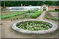
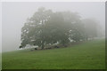
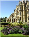
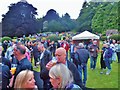
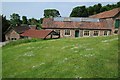
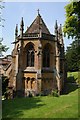
Photos of BS19 1NU


Area Information
Living in BS19 1NU locates you within the civil parish of Wraxall and Failand, a rural setting in the North Somerset district just six miles west of Bristol. This specific postcode cluster sits on the Failand Ridge, splitting the villages with Wraxall to the south and Failand to the north. The area is defined by its quiet character and compact size, home to a population of 1,653 residents. Historical layers inform the landscape, from Iron Age earthworks known as Wraxall Camp to All Saints Church, a Grade I listed building dating back to the 12th century with Norman elements. The manor of Wraxall Court traces origins to the Saxon period, passing through notable families before eventually reaching the Tynte dynasty, whose monuments stand nearby in Tyntesfield National Trust estate. St Bartholomew's Church in Lower Failand was constructed in 1887, establishing a separate ecclesiastical parish for that locality. Daily life here revolves around a blend of village charm and proximity to the city. The civil parish was officially renamed from Wraxall to Wraxall and Failand on 1 October 1996, reflecting the distinct identity of its northern and southern halves. Residents enjoy access to significant planning constraints free zones, with no coverage of Ramsar wetland sites, Areas of Outstanding Natural Beauty, or protected nature reserves or woodlands within the immediate assessment. This status supports development potential where legally permitted while maintaining the open feel of the ridge. The area offers a grounded experience where history, such as the early 17th-century Rectory, coexists with modern convenience. You are positioned away from the urban core but close enough to access Bristol's wider opportunities without the associated noise or congestion typical of city centres.
- Area Type
- Postcode
- Area Size
- Not available
- Population
- 1653
- Population Density
- 111 people/km²
The property market in BS19 1NU is characterised by stability and ownership rather than frequent turnover. With 83% home ownership, the area operates primarily as an owner-occupied zone. This statistic indicates that the majority of residents have either purchased their property outright or are in the process of paying off a mortgage, rather than living in the rental sector. Such a high proportion of owner-occupiers often results in a market that moves slower than urban areas, with transaction volumes dependent on life-cycle events like inheritance or relocation rather than investor activity. Accommodation types are strictly houses within this postcode. You will not encounter apartments and instead find standalone properties or semi-detached homes typical of rural Somerset villages. This housing stock catered to a population that values grounds, garages, and detached living. The concentration of houses supports a market where value is driven by plot size, condition of the property, and proximity to amenities like Nailsea or the surrounding countryside rather than rental yields. For buyers looking at homes in BS19 1NU, the scarcity of rental stock is a defining feature. The local market reflects long-term residency patterns, with properties often changing hands after decades of ownership. This environment creates a stable community where neighbours stay put, fostering deep local roots and a slower, more deliberate pace of real estate engagement compared to the rental-heavy districts found closer to Bristol city centre.
House Prices in BS19 1NU
No properties found in this postcode.
Energy Efficiency in BS19 1NU
Amenities
Schools
Families considering schools near BS19 1NU have access to a mix of state and independent provision within walking or short driving distance. The area is served by Wraxall Church of England Voluntary Aided Primary School and Wraxall Church of England Primary School, both state-funded institutions catering to the local catchment area. These schools provide education within the established village of Wraxall, integrating religious elements into their curriculum as indicated by their Church of England affiliation. For families seeking an alternative to state education or wishing for independent schooling options with different fee structures and curricular focuses, The Downs Preparatory School is available nearby. This independent provision adds variety to the local educational landscape without duplicating every service offered by the voluntary aided schools. The presence of both primary and preparatory options confirms that the immediate vicinity supports dependent children. However, the data does not specify Ofsted ratings for these institutions, so you must inquire directly with the schools regarding their latest inspection grades. The coexistence of these three establishments suggests a healthy demand for education in Wraxall and Failand. For commuters, the location remains advantageously close to Nailsea, where further secondary education options might lie, though specific secondary names are not listed in the local cluster data. You are situated in a zone where primary education is accessible without needing to travel deep into Bristol. The independent school presence also signals that the area attracts families with specific educational aspirations for their children.
| Rank | School | Type | Entry gender | Ages |
|---|
Explore more schools in this area
Go to Schools tabDemographics
The community profile for BS19 1NU reflects a distinctly mature population. The median age stands at 47 years, indicating that adults aged between 30 and 64 years are the most common age range. This demographic skew suggests a neighbourhood dominated by established households rather than young professionals or families with very young children. Consequently, local interaction likely centres on shared life experiences across middle age groups. Home ownership is the predominant tenure type, with 83% of residents owning their property outright. This high ownership rate implies long-term settlement and investment in the local infrastructure rather than short-term renting. Accommodation types are exclusively houses, meaning you will not find high-rise blocks or terraced flats within this specific cluster. The homogeneity of housing aligns with the age profile, favouring larger family homes or single-family dwellings suitable for older residents. While the predominant ethnic group is White, the area remains representative of broader national trends without specific minority concentration data provided in local breakdowns. The low population density of 111 people per square kilometre reinforces the spacious, low-density nature of the ridge location. This density figure is significantly lower than urban averages, contributing to a quieter environment. The demographic stability is further evidenced by the lack of transient markers; the high ownership percentage and mature age suggest a settled community where residents value the privacy and established character of Wraxall and Failand over the vibrancy of high-turnover urban zones.
Household Size
Accommodation Type
Tenure
Ethnic Group
Religion
Household Composition
Age
Household Deprivation
NS-SEC
Explore more demographic insights in this area
Go to Demographics tabPlanning
Planning Constraints
- Flood RiskPremium
- Ramsar Wetland SitesPremium
- Area of Outstanding Natural BeautyPremium
- Protected Nature ReservePremium
- Protected WoodlandPremium