Area Overview for BS18 9JW
Photos of BS18 9JW
Area Information
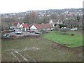
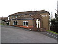
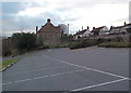
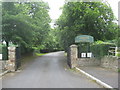
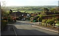
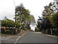
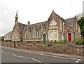
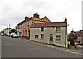
BS18 9JW is a small residential postcode area nestled in the heart of England, covering a compact cluster of homes with a population of 2172 people. The area’s density of 452 people per square kilometre suggests a tightly knit community, likely centred around traditional housing stock. While the precise geographical boundaries are not detailed, the region is historically linked to Long Ashton, a village with roots in Saxon times and a recorded presence in the Domesday Book. Proximity to Bristol and the River Avon adds to its charm, blending rural tranquillity with accessible urban connectivity. Daily life here is likely shaped by a mix of local traditions and modern amenities, with residents benefiting from nearby retail, transport links, and a low crime rate. The area’s character is defined by its modest scale, historical depth, and the presence of landmarks like the parish church of All Saints and Ashton Court Estate. For those seeking a quiet, established neighbourhood with a touch of heritage, BS18 9JW offers a distinctive blend of stability and accessibility.
- Area Type
- Postcode
- Area Size
- Not available
- Population
- 2172
- Population Density
- 452 people/km²
BS18 9JW is primarily an owner-occupied area, with 83% of homes owned by residents rather than rented. The accommodation type is predominantly houses, suggesting a market skewed towards family homes and traditional housing stock. This contrasts with areas dominated by flats or rental properties, indicating a community that prioritises permanence and property investment. The small scale of the postcode area means the housing stock is likely limited in variety, with fewer new developments or modern builds. For buyers, this could mean competition for existing homes, particularly those in good condition or with desirable features. The high home ownership rate also implies a stable market, with fewer fluctuations in property values. However, the lack of data on average house prices or recent sales trends means potential buyers should conduct further local inquiries to gauge current market dynamics.
House Prices in BS18 9JW
No properties found in this postcode.
Energy Efficiency in BS18 9JW
Living in BS18 9JW offers access to a range of amenities within practical reach. Retail options include Co-op Long, Sainsburys Winterstoke, and Iceland South Bristol Retail, providing everyday shopping needs. The area’s ferry landings, such as Nova Scotia and Pumphouse, add a unique dimension to local transport and leisure. Rail stations like Parson Street and Clifton Down connect residents to Bristol’s broader network, while Bristol Airport is a major nearby hub. Though the data does not specify parks or recreational spaces, the historical context of Long Ashton suggests proximity to natural features like the River Avon. The mix of retail, transport, and travel options creates a lifestyle that balances convenience with the potential for outdoor activities, though further local investigation would clarify the extent of green spaces or leisure facilities.
Amenities
Schools
The nearest school to BS18 9JW is Northleaze Church of England Primary School, a primary institution serving the area. No secondary schools are listed in the data, so families requiring secondary education would need to look beyond the immediate vicinity. The presence of a primary school suggests the area is suitable for young children, though parents should verify the school’s Ofsted rating and performance metrics independently. The single primary school may indicate a smaller local catchment area, which could be advantageous for community cohesion but may limit options for larger families or those seeking specialist provision. Without additional data on school capacity or pupil numbers, it is unclear whether the school serves the entire postcode area or only a portion of it.
| Rank | School | Type | Entry gender | Ages |
|---|
Explore more schools in this area
Go to Schools tabDemographics
The community in BS18 9JW is predominantly composed of adults aged 30–64, with a median age of 47. This suggests a mature population, likely with established careers and family structures. Home ownership is high at 83%, indicating a stable housing market with a focus on long-term residency rather than rental turnover. The area is characterised by houses rather than flats or apartments, reflecting a preference for detached or semi-detached properties. The predominant ethnic group is White, though specific diversity metrics are not provided. The age profile and ownership rates imply a community that values continuity and security. With no data on deprivation levels, it is reasonable to infer that the area’s quality of life is supported by its low crime risk and proximity to essential services. However, the absence of detailed socioeconomic data means broader conclusions about affordability or inequality remain speculative.
Household Size
Accommodation Type
Tenure
Ethnic Group
Religion
Household Composition
Age
Household Deprivation
NS-SEC
Explore more demographic insights in this area
Go to Demographics tabPlanning
Planning Constraints
- Flood RiskPremium
- Ramsar Wetland SitesPremium
- Area of Outstanding Natural BeautyPremium
- Protected Nature ReservePremium
- Protected WoodlandPremium