Area Overview for BS18 9HQ
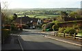
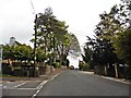
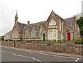
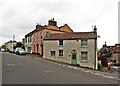
Photos of BS18 9HQ
Area Information
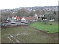
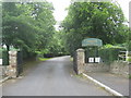
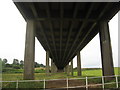
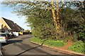
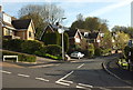
BS18 9HQ is a small, tightly knit residential cluster in North Somerset, England, with a population of 2172 people spread across 452 residents per square kilometre. Nestled near Bristol, this area blends historical roots with modern convenience. Long Ashton, the village it belongs to, dates back to Saxon times and is bounded by ancient parishes like Bedminster and Dundry, with the River Avon forming part of its borders. Daily life here is shaped by its proximity to Bristol’s infrastructure, including rail networks, ferry services, and two major airports. The area’s low population density suggests a quiet, community-focused environment, where residents can enjoy a slower pace of life while remaining within reach of urban amenities. The presence of multiple railway stations, such as Parson Street and Clifton Down, ensures easy access to Bristol’s cultural and economic hubs. For those seeking a balance between rural tranquillity and urban connectivity, BS18 9HQ offers a distinct blend of both.
- Area Type
- Postcode
- Area Size
- Not available
- Population
- 2172
- Population Density
- 452 people/km²
The property market in BS18 9HQ is characterised by high home ownership (83%) and a predominance of houses, suggesting a focus on owner-occupied homes rather than rental properties. This indicates a stable market where properties are likely to be held for the long term, reducing the likelihood of frequent turnover. The concentration of houses may also reflect the area’s residential nature, with larger properties catering to families. For buyers, this means a limited but potentially valuable pool of homes, particularly in a small postcode area. However, the immediate surroundings may offer more options, given the proximity to larger towns like Bristol. The high home ownership rate also implies strong community ties, with residents likely to invest in maintaining their properties. Prospective buyers should consider the small size of the postcode area when exploring nearby regions for additional choices.
House Prices in BS18 9HQ
No properties found in this postcode.
Energy Efficiency in BS18 9HQ
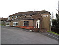
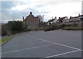
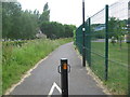
Residents of BS18 9HQ have access to a range of amenities within practical reach. Retail options include Co-op Long, Sainsburys Winterstoke, and Iceland South Bristol Retail, ensuring everyday shopping needs are met. Ferry landings such as Nova Scotia and Pumphouse provide easy access to water-based travel, while rail stations like Parson Street and Clifton Down connect to Bristol’s broader transport network. The area’s proximity to two airports adds to its appeal for those requiring frequent travel. For leisure, the nearby River Avon and historical sites like the parish church of All Saints offer opportunities for walking, history enthusiasts, and cultural engagement. This mix of retail, transport, and natural features contributes to a lifestyle that balances convenience with a touch of rural charm.
Amenities
Schools
The nearest school to BS18 9HQ is Northleaze Church of England Primary School, a primary school serving the local community. While the data lists this school twice, it is the only educational institution explicitly mentioned. The absence of secondary schools in the provided data means families may need to look beyond the immediate area for comprehensive schooling. The presence of a primary school suggests that the area is well-suited for young families, though parents seeking secondary education for their children would need to consider commuting to nearby towns like Bristol or Bath. The single school listed indicates a focus on primary education, which may be sufficient for younger children but necessitates planning for older students.
| Rank | School | Type | Entry gender | Ages |
|---|
Explore more schools in this area
Go to Schools tabDemographics
The demographic profile of BS18 9HQ reflects a mature, stable community. With a median age of 47 and the most common age range being adults aged 30–64, the area is predominantly occupied by middle-aged residents. Home ownership is high, at 83%, indicating a strong preference for long-term residency over rental properties. The accommodation type is primarily houses, which aligns with the area’s residential character and suggests a focus on family homes. The predominant ethnic group is White, which is consistent with broader trends in North Somerset. The absence of specific data on deprivation or diversity does not imply a lack of complexity, but the figures provided highlight a community that values stability and permanence. This demographic structure may influence local services and amenities, ensuring they cater to the needs of established households rather than transient populations.
Household Size
Accommodation Type
Tenure
Ethnic Group
Religion
Household Composition
Age
Household Deprivation
NS-SEC
Explore more demographic insights in this area
Go to Demographics tabPlanning
Planning Constraints
- Flood RiskPremium
- Ramsar Wetland SitesPremium
- Area of Outstanding Natural BeautyPremium
- Protected Nature ReservePremium
- Protected WoodlandPremium