Area Overview for BS18 9EG
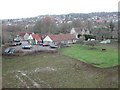
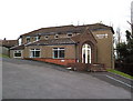
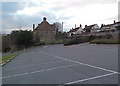
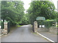
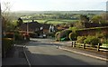
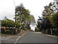
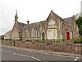
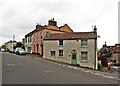
Photos of BS18 9EG
Area Information
BS18 9EG is a small, tightly knit residential postcode area nestled in the outskirts of North Somerset, England. With a population of 2,172 and a density of 452 people per square kilometre, it reflects a compact, community-oriented layout. The area’s character is shaped by its proximity to historic Long Ashton, a village with roots in Saxon times and listed landmarks like the parish church of All Saints and Ashton Court Estate. Daily life here is defined by a mature demographic, with a median age of 47 and a majority of residents aged 30–64. The high home ownership rate (83%) suggests a stable, long-term community, with most properties being houses rather than flats. Nearby, the Northleaze Church of England Primary School serves local families, while the area’s connectivity to rail, ferry, and road networks ensures easy access to Bristol and beyond. For buyers, BS18 9EG offers a blend of quiet living and practical access to amenities, with low crime risk and minimal environmental hazards. Its small size means it’s ideal for those seeking a balanced lifestyle with strong community ties and proximity to natural and cultural landmarks.
- Area Type
- Postcode
- Area Size
- Not available
- Population
- 2172
- Population Density
- 452 people/km²
The property market in BS18 9EG is dominated by owner-occupied homes, with 83% of properties owned by residents rather than rented out. This high home ownership rate indicates a stable, long-term community with limited turnover, which can be attractive to buyers seeking a secure investment. The accommodation type is primarily houses, reflecting a preference for larger, private properties over flats or apartments. This suggests a market suited to families or individuals prioritising space and privacy. Given the small size of the postcode area, the housing stock is likely limited, meaning buyers may need to consider nearby regions for more options. The absence of significant planning constraints, such as AONB or protected nature reserves, also makes the area appealing for those seeking development potential. However, the focus on houses means the market may cater more to those requiring larger properties rather than first-time buyers seeking smaller units.
House Prices in BS18 9EG
No properties found in this postcode.
Energy Efficiency in BS18 9EG
Living in BS18 9EG offers access to a range of practical amenities within reach. Retail options include Co-op Long, Sainsburys Winterstoke, and Iceland South Bristol Retail, providing everyday shopping needs. The area’s proximity to ferry landings, such as Cottage Ferry Landing, and rail stations like Clifton Down Railway Station ensures convenient travel for commuting or leisure. For those seeking more distant experiences, Bristol Airport is within easy reach, facilitating travel to other regions. The area’s historical and natural features, including the parish church of All Saints and the Gatcombe Roman Settlement, add cultural and recreational value. While the dataset does not detail parks or leisure facilities directly, the presence of nearby rail and ferry links suggests opportunities for outdoor activities in surrounding areas. The mix of retail, transport, and historical sites contributes to a lifestyle that balances convenience with access to broader regional amenities.
Amenities
Schools
The nearest school to BS18 9EG is the Northleaze Church of England Primary School, which serves the local community with primary education. The data lists this school twice, but it is the only educational institution explicitly mentioned. As a primary school, it caters to younger children, though no secondary schools are noted in the area. This means families may need to look further afield for secondary education options. The presence of a primary school suggests that the area is well-served for early childhood education, which is a key consideration for families. However, the lack of secondary schools nearby could be a limitation for those prioritising a single-school catchment area. The school’s type (Church of England) may align with specific educational or religious preferences, but no Ofsted ratings or performance data are provided in the dataset.
| Rank | School | Type | Entry gender | Ages |
|---|
Explore more schools in this area
Go to Schools tabDemographics
The population of BS18 9EG is predominantly composed of adults aged 30–64, with a median age of 47. This suggests a mature, established community where many residents have lived for years or decades. Home ownership is high at 83%, indicating a stable housing market with a focus on long-term residency rather than rental properties. The accommodation type is primarily houses, which aligns with the area’s residential character and the presence of historic estates like Ashton Court. The predominant ethnic group is White, reflecting the broader demographic trends of the region. While specific data on deprivation is not provided, the high home ownership rate and low crime score (87/100) imply a relatively affluent and secure environment. The population density of 452 people per square kilometre is moderate, balancing residential space with community interaction. This profile suggests a neighbourhood where families and older residents coexist, supported by local amenities and a low-risk environment.
Household Size
Accommodation Type
Tenure
Ethnic Group
Religion
Household Composition
Age
Household Deprivation
NS-SEC
Explore more demographic insights in this area
Go to Demographics tabPlanning
Planning Constraints
- Flood RiskPremium
- Ramsar Wetland SitesPremium
- Area of Outstanding Natural BeautyPremium
- Protected Nature ReservePremium
- Protected WoodlandPremium