Area Overview for BS18 9EB
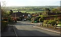
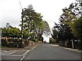
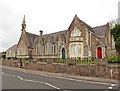
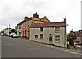
Photos of BS18 9EB
Area Information
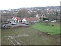
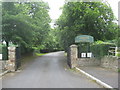
BS18 9EB is a small residential postcode area near Bristol, encompassing parts of Long Ashton and Leigh Woods. With a population of 2172 and a density of 452 people per square kilometre, it is a tightly knit community characterised by its historical roots and proximity to the River Avon. The area’s name, derived from its straggling layout along main roads and nearby brooks, reflects its rural yet accessible nature. Residents benefit from low crime rates, with a safety score of 87 out of 100, and minimal flood risk. The surrounding landscape includes ancient parishes, Roman artefacts, and the historic Ashton Court Estate. While small, the area offers practical connectivity to Bristol’s amenities, including rail links to Bedminster and Clifton Down stations, and proximity to Bristol Airport. Daily life here balances rural tranquillity with commuter convenience, making it appealing to those seeking a stable, family-oriented environment near urban centres.
- Area Type
- Postcode
- Area Size
- Not available
- Population
- 2172
- Population Density
- 452 people/km²
The property market in BS18 9EB is dominated by owner-occupied homes, with 83% of properties owned by residents rather than rented. The accommodation type is primarily houses, reflecting a preference for larger, more permanent dwellings. This suggests a market skewed towards established families and long-term residents, with limited rental availability. The small size of the area means housing stock is constrained, potentially increasing competition among buyers. For those seeking property, the focus on houses implies fewer apartments or terraced homes, which may appeal to those prioritising space and privacy. The high home ownership rate also indicates a stable market, with properties likely retaining value due to low turnover and the area’s safety profile. Buyers should consider the limited scope for new developments, given the small footprint and historical character of the region.
House Prices in BS18 9EB
No properties found in this postcode.
Energy Efficiency in BS18 9EB
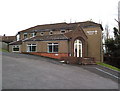
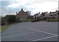
Residents of BS18 9EB have access to a range of amenities within practical reach. Retail options include Sainsburys Winterstoke, Iceland South Bristol Retail, and Co-op Long, providing everyday shopping needs. The area’s ferry landings, such as Cottage Ferry Landing, offer scenic routes along the River Avon, while rail stations like Bedminster connect to Bristol’s broader network. Proximity to Bristol Airport ensures easy travel for both leisure and business. The surrounding landscape includes historical sites like the parish church of All Saints and Ashton Court Estate, blending natural beauty with cultural heritage. This mix of practical amenities and historical interest supports a lifestyle that balances convenience with a connection to the area’s rich past. The presence of multiple retail outlets and transport links enhances daily life, making the area appealing to those seeking both accessibility and a sense of place.
Amenities
Schools
The nearest school to BS18 9EB is Northleaze Church of England Primary School, which serves the local community. The data lists this school twice, but it is the only named institution provided. As a primary school, it caters to younger children, though no Ofsted rating is included in the data. The absence of secondary schools or other educational institutions in the immediate vicinity suggests that families may need to look beyond the area for secondary education. This could be a consideration for those prioritising a comprehensive school network. However, the presence of a primary school indicates some local provision for younger children, though parents may need to plan for commuting to higher education levels. The limited school data means further research would be necessary to assess the full range of educational options available.
| Rank | School | Type | Entry gender | Ages |
|---|
Explore more schools in this area
Go to Schools tabDemographics
The community in BS18 9EB is predominantly composed of adults aged 30–64, with a median age of 47. This suggests a mature, established population, likely with strong ties to the area. Home ownership is high, at 83%, indicating a stable housing market and long-term residency. The accommodation type is primarily houses, which aligns with the area’s residential character. The predominant ethnic group is White, though no specific diversity statistics are provided. The age profile and ownership rates suggest a community focused on family living and long-term investment. The absence of deprivation data means the area’s quality of life is inferred from its safety, low crime rates, and access to amenities. This demographic profile supports a quiet, settled neighbourhood with minimal turnover, ideal for those prioritising stability and community cohesion.
Household Size
Accommodation Type
Tenure
Ethnic Group
Religion
Household Composition
Age
Household Deprivation
NS-SEC
Explore more demographic insights in this area
Go to Demographics tabPlanning
Planning Constraints
- Flood RiskPremium
- Ramsar Wetland SitesPremium
- Area of Outstanding Natural BeautyPremium
- Protected Nature ReservePremium
- Protected WoodlandPremium