Area Overview for BS18 9DF
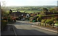
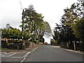
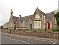
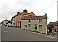
Photos of BS18 9DF
Area Information
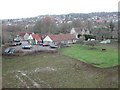
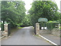
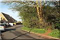
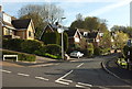
BS18 9DF is a small, tightly knit residential postcode area nestled near Long Ashton, a village with roots stretching back to Saxon times. With a population of 2,172 and a density of 452 people per square kilometre, it balances compact living with a quiet, village-like atmosphere. The area’s proximity to Bristol offers easy access to urban amenities while retaining the character of a historic parish. Long Ashton itself is bounded by ancient parishes and the River Avon, with landmarks like the parish church of All Saints and Ashton Court Estate adding to its heritage. Daily life here is shaped by a mature community, with a median age of 47 and a strong presence of adults aged 30–64. The area’s small size means a close-knit social fabric, where residents are likely to know their neighbours. For those seeking a blend of historical charm and modern convenience, BS18 9DF offers a distinct appeal, with no major planning constraints and low environmental risks.
- Area Type
- Postcode
- Area Size
- Not available
- Population
- 2172
- Population Density
- 452 people/km²
The property market in BS18 9DF is dominated by owner-occupied homes, with 83% of residents living in properties they own. This high rate of home ownership suggests a community of long-term residents, many of whom may have purchased properties as family homes or investments. The accommodation type is predominantly houses, rather than flats or apartments, which aligns with the area’s rural and semi-rural character. This housing stock is likely to include traditional semi-detached or detached homes, reflecting the historical and architectural heritage of Long Ashton. For buyers, this means a limited but distinct selection of properties, often with larger gardens and more space than typical urban developments. The small size of the postcode area means that properties are closely spaced, and the immediate surroundings may offer similar housing stock. Prospective buyers should consider the area’s proximity to Bristol for access to larger markets, though the local market is likely to be stable due to low environmental risks and strong community ties.
House Prices in BS18 9DF
No properties found in this postcode.
Energy Efficiency in BS18 9DF
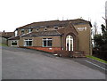
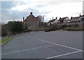
Residents of BS18 9DF have access to a range of nearby amenities, including five retail outlets such as Co-op Long, Sainsburys Winterstoke, and Iceland South Bristol Retail. These stores provide convenience for daily shopping, from groceries to household essentials. The area also includes five ferry landings, which may offer transport to nearby waterways or recreational opportunities. Rail stations like Parson Street and Clifton Down provide easy access to Bristol’s urban centres, while the proximity to Bristol Airport ensures connectivity for travel. The presence of multiple retail, transport, and leisure options within practical reach enhances the area’s appeal, offering both convenience and variety. For those who enjoy outdoor activities, the nearby River Avon and historical sites like Ashton Court Estate provide opportunities for walking, cycling, or exploring the region’s heritage. This mix of amenities supports a balanced lifestyle, blending rural tranquillity with urban accessibility.
Amenities
Schools
The nearest school to BS18 9DF is Northleaze Church of England Primary School, a primary institution serving the local community. While no Ofsted rating is provided in the data, the presence of a primary school indicates that the area is suitable for families with young children. The school’s name suggests a faith-based educational approach, which may align with the predominantly White and mature demographic of the area. However, the data does not specify whether secondary schools are nearby, so families requiring a full range of educational options may need to look beyond the immediate postcode. The single primary school listed highlights the need for additional educational facilities in the broader region, though the area’s small size may limit the availability of multiple schools within walking distance.
| Rank | School | Type | Entry gender | Ages |
|---|
Explore more schools in this area
Go to Schools tabDemographics
The community in BS18 9DF is predominantly composed of adults aged 30–64, with a median age of 47. This suggests a mature, stable population, likely with established careers and family ties. Home ownership is high, at 83%, indicating a strong preference for long-term residency over rental properties. The area is characterised by houses rather than flats, reflecting a preference for standalone living. The predominant ethnic group is White, though no specific data on diversity or deprivation is provided. The age profile implies a community with a focus on family life and retirement, with fewer young children or students compared to other areas. This demographic structure may influence local services and amenities, with a focus on adult-oriented facilities and community centres. The low population density of 452 people per square kilometre further supports a lifestyle prioritising space and privacy over urban density.
Household Size
Accommodation Type
Tenure
Ethnic Group
Religion
Household Composition
Age
Household Deprivation
NS-SEC
Explore more demographic insights in this area
Go to Demographics tabPlanning
Planning Constraints
- Flood RiskPremium
- Ramsar Wetland SitesPremium
- Area of Outstanding Natural BeautyPremium
- Protected Nature ReservePremium
- Protected WoodlandPremium