Area Overview for BS18 9AF
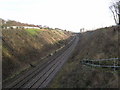
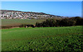
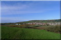
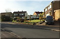
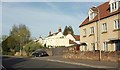
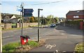
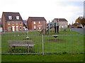
Photos of BS18 9AF


Area Information
BS18 9AF is a small, tightly knit postcode area in England, encompassing a residential cluster with a population of 2,673 people. Its population density of 1,435 people per square kilometre suggests a compact, community-focused layout. Situated near Bristol, the area is historically rooted, with ties to Long Ashton, a village noted in the Domesday Book as Estune. The landscape is defined by ancient parishes, rivers, and historic landmarks like All Saints Church and Ashton Court Estate. Daily life here balances rural tranquillity with proximity to urban amenities, with easy access to nearby towns and transport links. The area’s character is shaped by its Saxon origins and medieval heritage, offering residents a blend of historical significance and modern convenience. For those seeking a quiet yet connected lifestyle, BS18 9AF provides a stable environment with low crime rates and minimal environmental risks. Its small size means the community feels close-knit, with local shops, schools, and transport options within practical reach.
- Area Type
- Postcode
- Area Size
- Not available
- Population
- 2673
- Population Density
- 1435 people/km²
BS18 9AF is predominantly an owner-occupied area, with 76% of homes owned by residents rather than rented. The accommodation type is primarily houses, which is typical for smaller, rural or semi-rural postcode areas. This suggests a housing stock that is likely older, with a focus on detached or semi-detached properties. The high home ownership rate indicates a stable market, potentially with limited turnover, which could make property searches in this small area competitive. Buyers should consider nearby areas for a broader selection, as the immediate vicinity may have limited new developments. The presence of houses rather than flats or apartments aligns with the area’s low population density and residential character. For those seeking a home, the market here is likely to prioritise established properties over modern or speculative builds.
House Prices in BS18 9AF
No properties found in this postcode.
Energy Efficiency in BS18 9AF
The lifestyle in BS18 9AF is supported by a range of nearby amenities, including five retail outlets such as Co-op Long and Sainsburys Winterstoke, offering everyday shopping convenience. Five ferry landings provide access to water-based travel, while five rail stations, including Bedminster Railway Station, facilitate commuting to Bristol and beyond. The proximity to Bristol Airport ensures easy travel for those requiring frequent flights. The area’s mix of retail, transport, and leisure options fosters a practical, accessible lifestyle. Residents can enjoy a balance of local services and broader urban connectivity, with the added benefit of nearby natural features like the River Avon. The combination of small-town charm and modern amenities makes daily life here both convenient and varied.
Amenities
Schools
The nearest school to BS18 9AF is Birdwell Primary School, a primary-level institution. While no Ofsted rating is provided, the presence of a primary school within the area is significant for families with young children. The school’s proximity to the postcode area suggests it is a key educational resource for local residents. However, the data does not include information on secondary schools or other educational institutions, meaning families may need to look further afield for comprehensive schooling. The availability of a primary school supports the area’s appeal to families, though buyers should investigate secondary school options separately to ensure a full range of educational opportunities for their children.
| Rank | School | Type | Entry gender | Ages |
|---|
Explore more schools in this area
Go to Schools tabDemographics
The population of BS18 9AF has a median age of 47, with the majority of residents falling within the 30–64 age range. This suggests a community skewed towards middle-aged and older adults, likely reflecting long-term settlement patterns. Home ownership is high at 76%, indicating a stable, owner-occupied demographic. The predominant accommodation type is houses, which aligns with the area’s residential character and lower population density. The predominant ethnic group is White, though no specific data on diversity or deprivation is provided. The age profile implies a mature population, potentially with established careers and families, while the high home ownership rate suggests a preference for long-term residency over rental properties. This demographic structure may influence local services and amenities, tailored to the needs of a settled, older community.
Household Size
Accommodation Type
Tenure
Ethnic Group
Religion
Household Composition
Age
Household Deprivation
NS-SEC
Explore more demographic insights in this area
Go to Demographics tabPlanning
Planning Constraints
- Flood RiskPremium
- Ramsar Wetland SitesPremium
- Area of Outstanding Natural BeautyPremium
- Protected Nature ReservePremium
- Protected WoodlandPremium