Area Overview for BS18 2AG
Photos of BS18 2AG


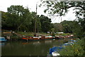
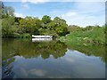
![Moored boats upstream [south] of Hanham Lock in BS18 2AG](https://images.propbar.co.uk/images/geograph/44/86/4486432_120.jpg)
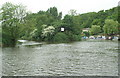
![River Avon nearing Park Corner, looking upstream [south] in BS18 2AG](https://images.propbar.co.uk/images/geograph/44/86/4486434_120.jpg)
Area Information
BS18 2AG lies in Keynsham, Somerset, a historic civil parish at the meeting point of the River Chew and River Avon, around 7¼ miles from Bath. This small postcode area covers a compact residential cluster with a population of 2,466, translating to a density of 598 people per square kilometre. The area has roots stretching back to the Anglo-Saxon era, with Keynsham Abbey founded in 1170 and the Church of St John the Baptist, a Grade II* listed building, standing as a testament to medieval heritage. Today, it balances historical charm with modern convenience. Residents benefit from proximity to Bath’s cultural offerings, while local amenities include retail hubs and transport links. The area’s economy once thrived on the Cadbury’s Somerdale chocolate factory, though its legacy now shapes the town’s character. With a median age of 47 and a strong home-ownership rate, BS18 2AG appeals to those seeking a settled, community-focused lifestyle near natural and historical landmarks.
- Area Type
- Postcode
- Area Size
- Not available
- Population
- 2466
- Population Density
- 598 people/km²
BS18 2AG is a predominantly owner-occupied area, with 77% of homes owned by residents rather than rented. The accommodation type is largely houses, reflecting the area’s historical development as a market town with spacious, traditional housing stock. This contrasts with urban areas where flats or apartments dominate. For buyers, this means a focus on single-family homes, which may appeal to those seeking private gardens or larger living spaces. The small postcode area’s limited size suggests a finite housing supply, potentially driving competition among buyers. Proximity to Bath and the M5 motorway could enhance property value, though the local economy’s reliance on historical and retail sectors may influence market dynamics. The absence of large-scale commercial development means the area retains a residential, low-density character.
House Prices in BS18 2AG
No properties found in this postcode.
Energy Efficiency in BS18 2AG
Residents of BS18 2AG enjoy a range of amenities within practical reach, including five retail outlets such as Tesco Keynsham and Iceland Keynsham, ensuring everyday shopping needs are met. Transport links are extensive, with five railway stations, two metro stops, and five ferry terminals providing flexibility for travel. The area’s historical and natural features, like the River Chew and River Avon, offer scenic backdrops, though specific parks or leisure facilities are not detailed in the data. The presence of Keynsham Abbey and the Church of St John the Baptist adds cultural depth to daily life. The mix of retail, transport, and heritage sites creates a balanced lifestyle, blending practicality with historical richness. While the data does not mention dining options, the proximity to Bath suggests access to a wider range of restaurants and cafes.
Amenities
Schools
Residents of BS18 2AG have access to Broadlands School, a primary school offering education for younger children, and Broadlands Academy, an academy with a Good Ofsted rating. This combination of primary and secondary education within the area provides families with a seamless transition from early years to secondary schooling. The academy’s Good rating indicates a school meeting national standards in teaching quality and student outcomes. For parents, this reduces the need for long commutes to larger towns like Bath or Bristol. The presence of two schools also suggests a well-established educational infrastructure, supporting the area’s demographic of middle-aged and older residents. However, no data is provided on pupil numbers or specific subjects offered, meaning further research would be needed for detailed comparisons.
| Rank | School | Type | Entry gender | Ages |
|---|
Explore more schools in this area
Go to Schools tabDemographics
The population of BS18 2AG is predominantly adults aged 30–64, reflecting a mature community with a median age of 47. Home ownership is high at 77%, indicating a stable, long-term resident base. The area is characterised by houses rather than flats, aligning with its traditional market-town roots. The predominant ethnic group is White, though specific diversity metrics are not provided. This demographic profile suggests a community prioritising family stability and established living. The age range implies a mix of middle-aged professionals and retirees, with fewer young families compared to areas with higher birth rates. The high home-ownership rate may reflect a preference for long-term investment in property, while the absence of detailed deprivation data means the area’s socioeconomic challenges remain unquantified.
Household Size
Accommodation Type
Tenure
Ethnic Group
Religion
Household Composition
Age
Household Deprivation
NS-SEC
Explore more demographic insights in this area
Go to Demographics tabPlanning
Planning Constraints
- Flood RiskPremium
- Ramsar Wetland SitesPremium
- Area of Outstanding Natural BeautyPremium
- Protected Nature ReservePremium
- Protected WoodlandPremium