Area Overview for BS18 1UA
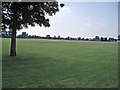
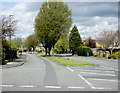
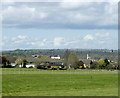
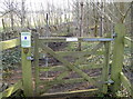
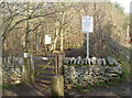
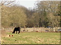
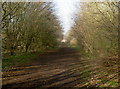
Photos of BS18 1UA
Area Information
BS18 1UA is a small residential cluster in Somerset, England, situated near the confluence of the River Chew and River Avon, approximately 7¼ miles west-north-west of Bath. With a population of 1,652 and a density of 1,209 people per square kilometre, this area reflects a tight-knit community with historical roots. Keynsham, the parish it belongs to, has been inhabited since prehistoric times and was a medieval market town shaped by Keynsham Abbey, founded in 1170. Today, it functions within the Bath and North East Somerset unitary authority. The area’s compact size means residents share proximity to amenities, schools, and transport links. Daily life here blends modern convenience with heritage, from the listed Church of St John the Baptist to the legacy of Cadbury’s Somerdale factory, which once employed locals. The median age of 47 suggests a mature population, with many households owning their homes. Living in BS18 1UA offers a mix of residential calm and access to nearby urban hubs, making it appealing for those seeking a balance between tranquillity and connectivity.
- Area Type
- Postcode
- Area Size
- Not available
- Population
- 1652
- Population Density
- 1209 people/km²
The property market in BS18 1UA is dominated by owner-occupied homes, with 78% of households owning their properties. This contrasts with rental markets in larger towns, indicating a focus on long-term residency. The accommodation type is primarily houses, which is uncommon in high-density areas but reflects the area’s historical development as a market town with spacious, traditional housing stock. For buyers, this means limited availability of flats or apartments, which may be a consideration for those seeking different property types. The small size of the postcode area suggests a tightly controlled housing market, with little scope for expansion. Potential buyers should note that the high home ownership rate may reduce the number of properties available for purchase, though the presence of nearby towns like Keynsham and Bath could offer alternative options. The mix of houses and the mature demographic may appeal to those prioritising stability and family-friendly environments.
House Prices in BS18 1UA
No properties found in this postcode.
Energy Efficiency in BS18 1UA
Living in BS18 1UA offers access to a range of amenities within practical reach. Retail options include Morrisons Daily Bristol, Morrisons Daily, and Waitrose Keynsham, providing grocery and daily essentials. The rail network connects residents to Keynsham, Oldfield Park, and Lawrence Hill stations, facilitating travel to nearby towns. Ferry terminals like Netham Lock and Temple Bridge offer scenic and functional transport links, ideal for those preferring water routes. While the area lacks explicit mention of parks or leisure facilities in the data, its proximity to the River Chew and River Avon suggests opportunities for outdoor activities. The presence of multiple retail outlets and transport hubs enhances convenience, allowing residents to shop, commute, and travel without long journeys. The blend of historical sites, such as Keynsham Abbey, with modern amenities creates a lifestyle that balances heritage with practicality.
Amenities
Schools
Residents of BS18 1UA have access to a range of primary and secondary schools. Chandag Junior School and Chandag Infant School cater to younger children, while IKB Academy provides secondary education with a ‘good’ Ofsted rating. Chandag Primary School adds to the primary school options, ensuring multiple choices for families. The presence of both primary and secondary institutions within proximity is a key advantage for parents seeking a full spectrum of education without long commutes. The duplication of Chandag Junior School in the data may indicate a recent merger or expansion, but the overall mix of school types supports families at different stages of their children’s education. For those prioritising school quality, IKB Academy’s ‘good’ rating offers reassurance, though specific performance metrics are not detailed. The density of schools reflects the area’s role as a residential hub for families.
| Rank | School | Type | Entry gender | Ages |
|---|
Explore more schools in this area
Go to Schools tabDemographics
The population of BS18 1UA is predominantly adults aged 30-64, with a median age of 47. This suggests a community of established professionals and families, many of whom own their homes—78% of households are owner-occupied, a figure higher than the national average. The area is characterised by houses rather than flats, reflecting a preference for single-family living. The predominant ethnic group is White, though specific diversity data is not provided. The high population density of 1,209 people per square kilometre indicates a compact, closely knit residential environment. For quality of life, this density may enhance community interaction but could also mean limited private space. The age profile suggests a stable demographic with fewer young dependents, which may influence local services and amenities. This data aligns with the area’s historical role as a market town, where long-term residents form the core of the community.
Household Size
Accommodation Type
Tenure
Ethnic Group
Religion
Household Composition
Age
Household Deprivation
NS-SEC
Explore more demographic insights in this area
Go to Demographics tabPlanning
Planning Constraints
- Flood RiskPremium
- Ramsar Wetland SitesPremium
- Area of Outstanding Natural BeautyPremium
- Protected Nature ReservePremium
- Protected WoodlandPremium