Area Overview for BS17 1ER
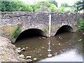
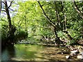
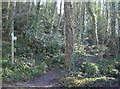
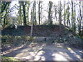
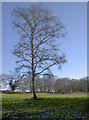
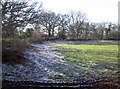
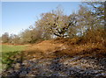
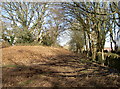
Photos of BS17 1ER
Area Information
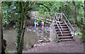
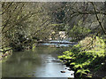
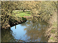
Living in BS17 1ER means being part of a small, tightly knit residential cluster in the heart of Winterbourne, a village with a rich historical legacy. The postcode covers a population of 1,587, nestled within the South Gloucestershire district. Winterbourne itself, with a broader population of around 1,834, is a civil parish marked by arable farmland, deciduous woodlands, and a network of historic sites. The M4 motorway, constructed in 1971, runs through the area, offering easy access to Bristol and beyond. The village’s charm lies in its blend of old and new: 50% of buildings date back to before the 19th century, while modern infrastructure ensures connectivity. Residents here tend to be adults aged 30–64, with a median age of 47, reflecting a community that values stability and tradition. The area’s proximity to rail, ferry, and motorway networks, combined with a low crime rate, makes it appealing for those seeking a balance between rural tranquillity and urban accessibility.
- Area Type
- Postcode
- Area Size
- Not available
- Population
- 1587
- Population Density
- 3775 people/km²
The property market in BS17 1ER is dominated by owner-occupied homes, with 86% of residents living in properties they own. This high rate of home ownership suggests a community that values stability and long-term residency. The accommodation type is predominantly houses, which aligns with the area’s suburban, low-density character. Given the small size of the postcode and its focus on single-family homes, the housing stock is likely limited in scale, making it a niche market for buyers seeking a traditional, private living environment. The presence of established homes, many of which predate the 19th century, indicates a mix of historic and modern properties. However, the small area size means buyers should consider nearby suburbs for additional options. The high home ownership rate also suggests a competitive market, where properties may hold value over time due to the area’s low crime rate and connectivity.
House Prices in BS17 1ER
No properties found in this postcode.
Energy Efficiency in BS17 1ER
Life in BS17 1ER is shaped by its proximity to a range of amenities that cater to daily needs. The area is served by five retail outlets, including Co-op Winterbourne, Tesco Winterbourne, and Budgens Mangotsfield, ensuring easy access to groceries and essentials. For transport, residents have five rail stations, a ferry terminal at Netham Lock, and two metro stops, facilitating both local and long-distance travel. The nearby Bristol Filton Airport, while not a major hub, offers regional connectivity. The village’s historical character is complemented by its practical amenities, such as St Michael’s School, founded in 1813, and the Friends Meeting House in Frenchay. The blend of retail, transport, and cultural landmarks creates a lifestyle that balances convenience with a sense of heritage. The presence of multiple transport options and local shops ensures that daily life is both efficient and enriched by the area’s unique identity.
Amenities
Schools
| Rank | School | Type | Entry gender | Ages |
|---|
Explore more schools in this area
Go to Schools tabDemographics
The community in BS17 1ER is predominantly composed of adults aged 30–64, with a median age of 47. This suggests a mature, established population, likely with strong ties to local institutions and long-term residency. Home ownership is exceptionally high at 86%, indicating a stable, owner-occupied demographic. The accommodation type is primarily houses, reflecting a low-density, suburban character. The predominant ethnic group is White, with no data provided on other demographics. This composition implies a community with a strong sense of continuity and shared values. The age profile suggests a population that may prioritise family-oriented living, with a lower proportion of younger or elderly residents compared to other areas. The high home ownership rate also points to a market where property is seen as a long-term investment rather than a short-term rental asset.
Household Size
Accommodation Type
Tenure
Ethnic Group
Religion
Household Composition
Age
Household Deprivation
NS-SEC
Explore more demographic insights in this area
Go to Demographics tabPlanning
Planning Constraints
- Flood RiskPremium
- Ramsar Wetland SitesPremium
- Area of Outstanding Natural BeautyPremium
- Protected Nature ReservePremium
- Protected WoodlandPremium