Area Overview for BS17 1AR
Photos of BS17 1AR
Area Information
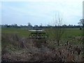
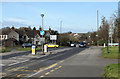
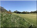
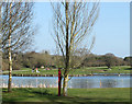
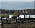
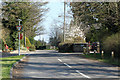
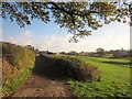
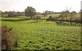
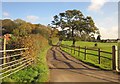
BS17 1AR is a small residential postcode in South Gloucestershire, encompassing parts of the villages of Westerleigh and Coalpit Heath. With a population of 1,939 and a density of 133 people per square kilometre, it reflects a quiet, rural settlement with a strong historical footprint. The area’s character is shaped by its past as a coal-mining parish, with remnants of that industry still visible in the landscape. Today, it offers a mix of traditional housing and modern amenities, supported by nearby transport links such as the M4 motorway and multiple railway stations. The community is predominantly middle-aged, with a median age of 47, and 81% of residents owning their homes. Daily life here is defined by proximity to nature, with Bitterwell Lake and the Frome Valley Walkway nearby, and a blend of practical retail options and historic sites like St James the Great Church. For those seeking a low-key, family-friendly environment with access to both countryside and urban convenience, BS17 1AR presents a distinctive blend of heritage and modernity.
- Area Type
- Postcode
- Area Size
- Not available
- Population
- 1939
- Population Density
- 133 people/km²
BS17 1AR is predominantly an owner-occupied area, with 81% of residents living in homes they own. The accommodation type is primarily houses, which suggests a focus on larger properties rather than flats or apartments. This aligns with the area’s rural character and historical development as a village cluster. Given the small population and limited land area, the housing stock is likely constrained, with limited scope for new builds or rental properties. Buyers should consider the proximity to nearby towns like Yate and Bristol for more extensive property options. The high home-ownership rate indicates a stable market, but the small size of the postcode means competition for available homes could be fierce. For those seeking a traditional, low-density residential environment, BS17 1AR offers a niche market with a strong emphasis on private, family-oriented living.
House Prices in BS17 1AR
No properties found in this postcode.
Energy Efficiency in BS17 1AR
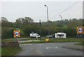
Living in BS17 1AR offers a mix of practical amenities and historical charm. Nearby retail options include Sainsburys, Lidl, and Budgens Mangotsfield, ensuring everyday shopping needs are met. The area’s transport links, including rail and ferry services, provide access to larger urban centres. Natural attractions like Bitterwell Lake and the Frome Valley Walkway offer recreational opportunities, while Coalpit Heath Cricket Club and the 27-hole Kendleshire Golf Course cater to leisure activities. The village’s heritage is evident in sites such as St James the Great Church and St Saviour’s parish church, adding cultural depth. With a blend of countryside and convenience, BS17 1AR supports a lifestyle that balances tranquillity with accessibility to essential services and community activities.
Amenities
Schools
The schools nearest to BS17 1AR include Vinney Green Secure Unit, which is categorised as an ‘other’ institution, and Immanuel Christian School, an independent school with a ‘good’ Ofsted rating. The presence of an independent school suggests options for families seeking alternative education models, while the secure unit may cater to specific needs. However, the data does not include state-funded schools, which could limit choices for those prioritising local public education. The absence of detailed school performance data means prospective families should investigate further to understand the full range of educational provisions. For those valuing a ‘good’ rated independent school alongside other facilities, Immanuel Christian School provides a notable option, though the overall school landscape in the area remains sparse.
| Rank | School | Type | Entry gender | Ages |
|---|
Explore more schools in this area
Go to Schools tabDemographics
The population of BS17 1AR is 1,939, with a median age of 47, indicating a mature demographic skewed toward adults aged 30–64. This age range suggests a community with established careers and family structures, reflecting the area’s history as a working village. Home ownership is high at 81%, with the majority of properties being houses rather than flats, pointing to a preference for larger, private residences. The predominant ethnic group is White, aligning with broader trends in rural South Gloucestershire. The population density of 133 people per square kilometre implies a low-rise, spread-out settlement rather than a densely populated town. This profile suggests a stable, low-deprivation community where residents are likely to value privacy, historical continuity, and proximity to natural amenities. The absence of detailed data on deprivation or diversity means the area’s social fabric is largely defined by its older, home-owning demographic and traditional rural lifestyle.
Household Size
Accommodation Type
Tenure
Ethnic Group
Religion
Household Composition
Age
Household Deprivation
NS-SEC
Explore more demographic insights in this area
Go to Demographics tabPlanning
Planning Constraints
- Flood RiskPremium
- Ramsar Wetland SitesPremium
- Area of Outstanding Natural BeautyPremium
- Protected Nature ReservePremium
- Protected WoodlandPremium