Area Overview for BS16 9SZ
Photos of BS16 9SZ
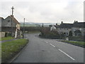
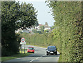
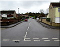
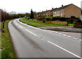
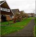
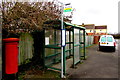
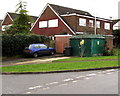
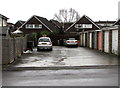
81 photos from this area
Area Information
Key information about the BS16 9SZ including its size, population, and administrative classification.
- Area Type
- Postcode
- Area Size
- 8568 m²
- Population
- 1067
- Population Density
- 1795 people/km²
House Prices in BS16 9SZ
32
Properties
£202,580
Average Sold Price
£62,950
Lowest Price
£320,000
Highest Price
Showing 32 properties
| Address | Type | Beds | Baths | Last Sale Price | Last Sale Date | |
|---|---|---|---|---|---|---|
| 41 Hawthorn Close, Pucklechurch, BS16 9SZ | Terraced | 3 | 1 | £282,000 | Oct 2025 | |
| 47 Hawthorn Close, Pucklechurch, BS16 9SZ | Terraced | 3 | 1 | £267,500 | Jan 2025 | |
| 46 Hawthorn Close, Pucklechurch, BS16 9SZ | Terraced | 3 | 1 | £280,000 | Jun 2023 | |
| 54 Hawthorn Close, Pucklechurch, BS16 9SZ | Semi-detached | 3 | 1 | £320,000 | Feb 2023 | |
| 44 Hawthorn Close, Pucklechurch, BS16 9SZ | Terraced | 3 | 1 | £275,000 | Apr 2022 | |
| 45 Hawthorn Close, Pucklechurch, BS16 9SZ | house | - | - | £250,000 | Sep 2021 | |
| 36 Hawthorn Close, Pucklechurch, BS16 9SZ | Terraced | 3 | - | £243,000 | Sep 2021 | |
| 35 Hawthorn Close, Pucklechurch, BS16 9SZ | house | - | - | £270,000 | Jul 2021 | |
| 33 Hawthorn Close, Pucklechurch, BS16 9SZ | Terraced | 3 | - | £260,000 | May 2021 | |
| 52 Hawthorn Close, Pucklechurch, BS16 9SZ | Terraced | 3 | - | £249,950 | Jul 2020 |
Page 1 of 4
Energy Efficiency in BS16 9SZ
Amenities
Schools
| Rank | School | Type | Entry gender | Ages |
|---|
Explore more schools in this area
Go to Schools tabDemographics
Household Size
Family (3-5 people)
most common
Accommodation Type
Houses
most common
Tenure
86
majority
Ethnic Group
White
most common
Religion
N/A
most common
Household Composition
N/A
most common
Age
47
median
Adults (30-64 years)
most common
Household Deprivation
N/A
with no deprivation
NS-SEC
33
in Lower managerial occupations
Explore more demographic insights in this area
Go to Demographics tabPlanning
Planning Constraints
- Flood RiskPremium
- Ramsar Wetland SitesPremium
- Area of Outstanding Natural BeautyPremium
- Protected Nature ReservePremium
- Protected WoodlandPremium