Area Overview for BS16 9LH
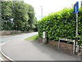
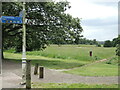
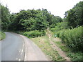
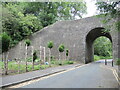
Photos of BS16 9LH


Area Information
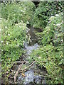
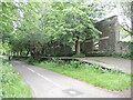
BS16 9LH lies within the suburban neighbourhood of Emersons Green, a civil parish in South Gloucestershire, approximately 7 miles northeast of Bristol city centre. This small postcode area covers 4.8 hectares and is home to 1,699 residents, reflecting a compact, residential cluster with a distinct suburban character. Developed in the 1990s and early 21st century on former farmland, the area contrasts with its historical roots in agriculture and coal mining. Today, it blends modern housing estates with preserved green spaces, including ponds, lakes, and wildlife corridors. The proximity to the M4 motorway and A4174 ring road ensures easy access to Bristol and surrounding regions, while nearby villages like Mangotsfield and Downend offer additional amenities. Residents benefit from a mix of new and historic sites, such as Vinney Green House and the Lyde Green Roman Villa, adding cultural depth to daily life. The area’s balance of modern convenience and greenery makes it appealing for families and professionals seeking a quieter lifestyle near major urban hubs.
- Area Type
- Postcode
- Area Size
- 4.8 hectares
- Population
- 1699
- Population Density
- 268 people/km²
The property market in BS16 9LH is predominantly owner-occupied, with 75% of homes owned by residents rather than rented. The accommodation type is primarily houses, reflecting a suburban character with larger, family-friendly properties. This contrasts with areas dominated by flats or rental units, suggesting a market more suited to long-term residency than short-term investment. The small area size and limited housing stock mean competition for properties is likely to be strong, particularly for newer developments. Buyers should consider the area’s proximity to green spaces and transport links, which enhance its appeal. However, the lack of high-density housing may limit options for those seeking smaller or more affordable properties. The predominance of owner-occupied homes also indicates a stable market, with fewer fluctuations in property values compared to areas with higher rental activity.
House Prices in BS16 9LH
Showing 2 properties
Energy Efficiency in BS16 9LH
Residents of BS16 9LH have access to a range of amenities within practical reach, including retail options like Tesco Mangotsfield, Tesco Staple, and Sainsburys Emersons. These stores provide everyday shopping convenience, from groceries to household essentials. The area’s proximity to metro stops at Oldland and Bitton, along with rail stations such as Bristol Parkway and Lawrence Hill, facilitates easy travel to nearby towns and cities. Ferry terminals like Netham Lock and Temple Meads offer additional connectivity, particularly for commuters or those using water-based transport. The nearby Bristol Filton Airport caters to regional and international travel needs. The mix of retail, transport, and leisure options supports a balanced lifestyle, with opportunities for shopping, commuting, and recreation. The presence of green spaces and historical sites further enriches the area’s character, making it suitable for those seeking both convenience and a connection to the surrounding environment.
Amenities
Schools
The nearest schools to BS16 9LH include Mangotsfield School, which operates as both a primary school and an academy with a good Ofsted rating. This dual role provides families with a seamless transition from primary to secondary education within the same institution. The academy’s good rating suggests a strong focus on academic standards and student welfare, though specific details on curriculum or facilities are not provided. The presence of a single primary school and an academy indicates a limited choice of educational institutions, which may be a consideration for families seeking diverse options. However, the proximity of Mangotsfield School to the area ensures accessibility for residents, reducing the need for long commutes. The absence of other schools in the immediate vicinity means parents may need to look to nearby villages for additional options, but the existing institutions are likely sufficient for most local needs.
| Rank | School | Type | Entry gender | Ages |
|---|
Explore more schools in this area
Go to Schools tabDemographics
The population of BS16 9LH is 1,699, with a median age of 47 and the majority of residents aged 30–64. This suggests a mature, stable community with a focus on family living. Home ownership is high at 75%, indicating a strong presence of long-term residents and a market skewed towards owner-occupied properties. The predominant accommodation type is houses, reflecting a suburban layout rather than high-density living. The predominant ethnic group is White, though specific data on diversity or deprivation is not provided. The age profile implies a mix of established households and retirees, with fewer young families or students. This demographic profile supports a community-oriented environment, with local amenities and schools catering to a range of age groups. The absence of specific deprivation statistics means the area’s quality of life remains unquantified, but the demographic stability suggests a low turnover of residents and a cohesive local identity.
Household Size
Accommodation Type
Tenure
Ethnic Group
Religion
Household Composition
Age
Household Deprivation
NS-SEC
Explore more demographic insights in this area
Go to Demographics tabPlanning
Planning Constraints
- Flood RiskPremium
- Ramsar Wetland SitesPremium
- Area of Outstanding Natural BeautyPremium
- Protected Nature ReservePremium
- Protected WoodlandPremium