Area Overview for BS16 7TA
Photos of BS16 7TA


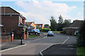
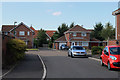
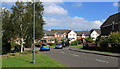
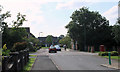

17 photos from this area
Area Information
Key information about the BS16 7TA including its size, population, and administrative classification.
- Area Type
- Postcode
- Area Size
- 2.2 hectares
- Population
- Not available
- Population Density
- Not available
House Prices in BS16 7TA
39
Properties
£232,826
Average Sold Price
£82,500
Lowest Price
£620,000
Highest Price
Showing 39 properties
| Address | Type | Beds | Baths | Last Sale Price | Last Sale Date | |
|---|---|---|---|---|---|---|
| 56 Thomas Avenue, Emersons Green, BS16 7TA | Detached | 4 | 2 | £575,000 | Oct 2025 | |
| 66 Thomas Avenue, Emersons Green, BS16 7TA | Bungalow | 2 | 2 | £425,000 | Jul 2024 | |
| 38 Thomas Avenue, Emersons Green, BS16 7TA | Semi-detached | 2 | 2 | £335,000 | May 2024 | |
| 74 Thomas Avenue, Emersons Green, BS16 7TA | Semi-detached | 2 | 1 | £320,000 | Nov 2023 | |
| 72 Thomas Avenue, Emersons Green, BS16 7TA | Semi-detached | 2 | 2 | £276,000 | Aug 2023 | |
| 16 Thomas Avenue, Emersons Green, BS16 7TA | Detached | 4 | 2 | £620,000 | Aug 2023 | |
| 48 Thomas Avenue, Emersons Green, BS16 7TA | house | - | - | £345,000 | Mar 2021 | |
| 54 Thomas Avenue, Emersons Green, BS16 7TA | Detached | 3 | 2 | £375,000 | Mar 2021 | |
| 70 Thomas Avenue, Emersons Green, BS16 7TA | Bungalow | - | - | £300,000 | Oct 2017 | |
| 40 Thomas Avenue, Emersons Green, BS16 7TA | house | 2 | - | £235,000 | Apr 2016 |
Page 1 of 4
Energy Efficiency in BS16 7TA
Amenities
Schools
| Rank | School | Type | Entry gender | Ages |
|---|
Explore more schools in this area
Go to Schools tabDemographics
Household Size
Family (3-5 people)
most common
Accommodation Type
Houses
most common
Tenure
72
majority
Ethnic Group
White
most common
Religion
N/A
most common
Household Composition
N/A
most common
Age
47
median
Adults (30-64 years)
most common
Household Deprivation
N/A
with no deprivation
NS-SEC
45
in Lower managerial occupations
Explore more demographic insights in this area
Go to Demographics tabPlanning
Planning Constraints
- Flood RiskPremium
- Ramsar Wetland SitesPremium
- Area of Outstanding Natural BeautyPremium
- Protected Nature ReservePremium
- Protected WoodlandPremium