Area Overview for BS16 7NG
Photos of BS16 7NG

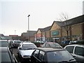
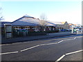
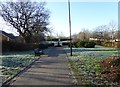
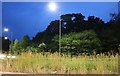

34 photos from this area
Area Information
Key information about the BS16 7NG including its size, population, and administrative classification.
- Area Type
- Postcode
- Area Size
- 1.7 hectares
- Population
- 1597
- Population Density
- 2575 people/km²
House Prices in BS16 7NG
67
Properties
£349,482
Average Sold Price
£107,500
Lowest Price
£659,181
Highest Price
Showing 67 properties
| Address | Type | Beds | Baths | Last Sale Price | Last Sale Date | |
|---|---|---|---|---|---|---|
| 72 Tulip Road, Emersons Green, BS16 7NG | Detached | 3 | 2 | £375,000 | Dec 2025 | |
| 3 Tulip Road, Emersons Green, BS16 7NG | Detached | 3 | 2 | £382,000 | Nov 2025 | |
| 39 Tulip Road, Emersons Green, BS16 7NG | Flat | 2 | 1 | £252,000 | Jul 2025 | |
| 16 Tulip Road, Emersons Green, BS16 7NG | house | - | - | £320,000 | Dec 2024 | |
| 35 Tulip Road, Emersons Green, BS16 7NG | Flat | - | - | £250,000 | Aug 2023 | |
| 33 Tulip Road, Emersons Green, BS16 7NG | Flat | - | - | £185,000 | Aug 2023 | |
| 70 Tulip Road, Emersons Green, BS16 7NG | house | - | - | £345,000 | Jun 2023 | |
| 17 Tulip Road, Emersons Green, BS16 7NG | house | - | - | £425,000 | Jun 2023 | |
| 68 Tulip Road, Emersons Green, BS16 7NG | house | - | - | £312,995 | Mar 2023 | |
| 66 Tulip Road, Emersons Green, BS16 7NG | house | - | - | £314,995 | Mar 2023 |
Page 1 of 7
Energy Efficiency in BS16 7NG
Amenities
Schools
| Rank | School | Type | Entry gender | Ages |
|---|
Explore more schools in this area
Go to Schools tabDemographics
Household Size
Family (3-5 people)
most common
Accommodation Type
Houses
most common
Tenure
70
majority
Ethnic Group
White
most common
Religion
N/A
most common
Household Composition
N/A
most common
Age
22
median
Adults (30-64 years)
most common
Household Deprivation
N/A
with no deprivation
NS-SEC
50
in Lower managerial occupations
Explore more demographic insights in this area
Go to Demographics tabPlanning
Planning Constraints
- Flood RiskPremium
- Ramsar Wetland SitesPremium
- Area of Outstanding Natural BeautyPremium
- Protected Nature ReservePremium
- Protected WoodlandPremium