Area Overview for BS16 6XB
Photos of BS16 6XB
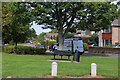
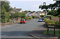
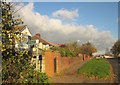
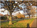
16 photos from this area
Area Information
Key information about the BS16 6XB including its size, population, and administrative classification.
- Area Type
- Postcode
- Area Size
- 1.3 hectares
- Population
- Not available
- Population Density
- Not available
House Prices in BS16 6XB
22
Properties
£272,281
Average Sold Price
£95,000
Lowest Price
£560,000
Highest Price
Showing 22 properties
| Address | Type | Beds | Baths | Last Sale Price | Last Sale Date | |
|---|---|---|---|---|---|---|
| 2 Stockwell Close, Downend, BS16 6XB | Detached | 5 | 1 | £500,000 | Jun 2023 | |
| 21 Stockwell Close, Downend, BS16 6XB | Detached | 6 | 2 | £560,000 | Nov 2018 | |
| Chimes Valley Lodge, 9A Stockwell Close, Downend, BS16 6XB | Detached | 4 | - | £500,000 | Jan 2017 | |
| 16 Stockwell Close, Downend, BS16 6XB | Detached | 5 | 1 | £310,000 | Sep 2015 | |
| 1 Stockwell Close, Downend, BS16 6XB | Detached | 4 | - | £270,000 | Jan 2014 | |
| 12 Stockwell Close, Downend, BS16 6XB | house | - | - | £277,000 | Aug 2013 | |
| 11 Stockwell Close, Downend, BS16 6XB | house | - | - | £300,000 | May 2013 | |
| 9 Stockwell Close, Downend, BS16 6XB | house | 4 | - | £260,000 | Nov 2010 | |
| 7 Stockwell Close, Downend, BS16 6XB | house | - | - | £300,000 | Dec 2009 | |
| 3 Stockwell Close, Downend, BS16 6XB | Detached | - | - | £235,000 | Sep 2005 |
Page 1 of 3
Energy Efficiency in BS16 6XB
Amenities
Schools
| Rank | School | Type | Entry gender | Ages |
|---|
Explore more schools in this area
Go to Schools tabDemographics
Household Size
Family (3-5 people)
most common
Accommodation Type
Houses
most common
Tenure
76
majority
Ethnic Group
White
most common
Religion
N/A
most common
Household Composition
N/A
most common
Age
47
median
Adults (30-64 years)
most common
Household Deprivation
N/A
with no deprivation
NS-SEC
35
in Lower managerial occupations
Explore more demographic insights in this area
Go to Demographics tabPlanning
Planning Constraints
- Flood RiskPremium
- Ramsar Wetland SitesPremium
- Area of Outstanding Natural BeautyPremium
- Protected Nature ReservePremium
- Protected WoodlandPremium