Area Overview for BS16 6UB
Photos of BS16 6UB
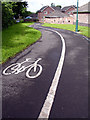

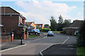
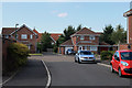
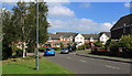
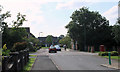
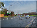
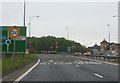
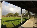
17 photos from this area
Area Information
Key information about the BS16 6UB including its size, population, and administrative classification.
- Area Type
- Postcode
- Area Size
- 1.5 hectares
- Population
- 1788
- Population Density
- 5742 people/km²
House Prices in BS16 6UB
25
Properties
£218,004
Average Sold Price
£87,100
Lowest Price
£418,000
Highest Price
Showing 25 properties
| Address | Type | Beds | Baths | Last Sale Price | Last Sale Date | |
|---|---|---|---|---|---|---|
| 117 Westerleigh Road, Downend, BS16 6UB | Terraced | 3 | 1 | £290,000 | Nov 2024 | |
| 115 Westerleigh Road, Downend, BS16 6UB | Detached | 2 | 1 | £252,500 | Feb 2024 | |
| 103 Westerleigh Road, Downend, BS16 6UB | Terraced | 2 | 1 | £265,500 | May 2023 | |
| 158 Westerleigh Road, Downend, BS16 6UB | Detached | 4 | 2 | £418,000 | Sep 2021 | |
| 101 Westerleigh Road, Downend, BS16 6UB | Terraced | 2 | - | £225,000 | Feb 2020 | |
| 129 Westerleigh Road, Downend, BS16 6UB | house | - | - | £87,100 | Jan 2016 | |
| 123 Westerleigh Road, Downend, BS16 6UB | Semi-detached | 2 | - | £160,000 | Jun 2014 | |
| 107 Westerleigh Road, Downend, BS16 6UB | Terraced | 3 | - | £169,000 | Apr 2014 | |
| 111 Westerleigh Road, Downend, BS16 6UB | house | 3 | - | £136,000 | May 2010 | |
| 109 Westerleigh Road, Downend, BS16 6UB | house | - | - | £158,950 | Jul 2007 |
Page 1 of 3
Energy Efficiency in BS16 6UB
Amenities
Schools
| Rank | School | Type | Entry gender | Ages |
|---|
Explore more schools in this area
Go to Schools tabDemographics
Household Size
One person
most common
Accommodation Type
Houses
most common
Tenure
52
majority
Ethnic Group
White
most common
Religion
N/A
most common
Household Composition
N/A
most common
Age
47
median
Adults (30-64 years)
most common
Household Deprivation
N/A
with no deprivation
NS-SEC
24
in Lower managerial occupations
Explore more demographic insights in this area
Go to Demographics tabPlanning
Planning Constraints
- Flood RiskPremium
- Ramsar Wetland SitesPremium
- Area of Outstanding Natural BeautyPremium
- Protected Nature ReservePremium
- Protected WoodlandPremium