Area Overview for BS16 6RU
Photos of BS16 6RU
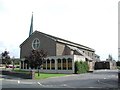
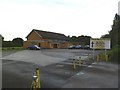
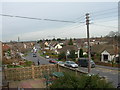
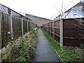
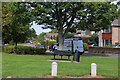
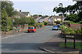
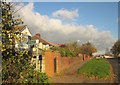
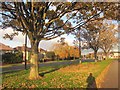
16 photos from this area
Area Information
Key information about the BS16 6RU including its size, population, and administrative classification.
- Area Type
- Postcode
- Area Size
- 7698 m²
- Population
- 1588
- Population Density
- 4607 people/km²
House Prices in BS16 6RU
20
Properties
£214,912
Average Sold Price
£63,000
Lowest Price
£425,000
Highest Price
Showing 20 properties
| Address | Type | Beds | Baths | Last Sale Price | Last Sale Date | |
|---|---|---|---|---|---|---|
| 31 Westbourne Road, Downend, BS16 6RU | Semi-detached | 4 | 2 | £425,000 | Jul 2025 | |
| 47 Westbourne Road, Downend, BS16 6RU | house | - | - | £300,000 | Oct 2020 | |
| 27 Westbourne Road, Downend, BS16 6RU | house | - | - | £329,995 | Mar 2020 | |
| 49 Westbourne Road, Downend, BS16 6RU | Semi-detached | 3 | - | £303,000 | Sep 2019 | |
| 43 Westbourne Road, Downend, BS16 6RU | Semi-detached | 3 | 1 | £287,000 | Jul 2017 | |
| 25 Westbourne Road, Downend, BS16 6RU | Semi-detached | 3 | - | £245,000 | Nov 2013 | |
| 41 Westbourne Road, Downend, BS16 6RU | house | - | - | £148,500 | Mar 2009 | |
| 21 Westbourne Road, Downend, BS16 6RU | Semi-detached | - | - | £65,200 | Jul 2007 | |
| 37 Westbourne Road, Downend, BS16 6RU | Detached | 3 | 2 | £209,950 | May 2007 | |
| 45 Westbourne Road, Downend, BS16 6RU | Semi-detached | - | - | £188,950 | May 2006 |
Page 1 of 2
Energy Efficiency in BS16 6RU
Amenities
Schools
| Rank | School | Type | Entry gender | Ages |
|---|
Explore more schools in this area
Go to Schools tabDemographics
Household Size
Family (3-5 people)
most common
Accommodation Type
Houses
most common
Tenure
89
majority
Ethnic Group
White
most common
Religion
N/A
most common
Household Composition
N/A
most common
Age
47
median
Adults (30-64 years)
most common
Household Deprivation
N/A
with no deprivation
NS-SEC
41
in Lower managerial occupations
Explore more demographic insights in this area
Go to Demographics tabPlanning
Planning Constraints
- Flood RiskPremium
- Ramsar Wetland SitesPremium
- Area of Outstanding Natural BeautyPremium
- Protected Nature ReservePremium
- Protected WoodlandPremium