Area Overview for BS16 6NP
Photos of BS16 6NP
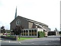
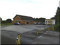
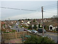
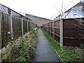
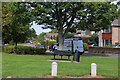
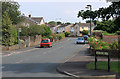
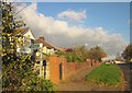
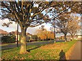
16 photos from this area
Area Information
Key information about the BS16 6NP including its size, population, and administrative classification.
- Area Type
- Postcode
- Area Size
- 1.6 hectares
- Population
- 1523
- Population Density
- 3766 people/km²
House Prices in BS16 6NP
27
Properties
£280,229
Average Sold Price
£69,000
Lowest Price
£640,000
Highest Price
Showing 27 properties
| Address | Type | Beds | Baths | Last Sale Price | Last Sale Date | |
|---|---|---|---|---|---|---|
| 186 Badminton Road, Downend, BS16 6NP | Detached | 3 | 1 | £455,000 | Aug 2025 | |
| 220 Badminton Road, Downend, BS16 6NP | Detached | 5 | 2 | £640,000 | Feb 2024 | |
| 224 Badminton Road, Downend, BS16 6NP | Semi-detached | 4 | 2 | £502,000 | Nov 2023 | |
| 206 Badminton Road, Downend, BS16 6NP | house | - | - | £373,000 | Apr 2021 | |
| 198 Badminton Road, Downend, BS16 6NP | house | - | - | £425,000 | Mar 2021 | |
| 212 Badminton Road, Downend, BS16 6NP | Semi-detached | 3 | 2 | £352,000 | Jun 2017 | |
| 188 Badminton Road, Downend, BS16 6NP | house | 3 | 1 | £245,000 | Jun 2011 | |
| 218 Badminton Road, Downend, BS16 6NP | house | - | - | £345,000 | Feb 2011 | |
| 208 Badminton Road, Downend, BS16 6NP | house | - | - | £295,000 | Dec 2010 | |
| 216 Badminton Road, Downend, BS16 6NP | house | - | - | £320,000 | Nov 2010 |
Page 1 of 3
Energy Efficiency in BS16 6NP
Amenities
Schools
| Rank | School | Type | Entry gender | Ages |
|---|
Explore more schools in this area
Go to Schools tabDemographics
Household Size
Two person
most common
Accommodation Type
Houses
most common
Tenure
88
majority
Ethnic Group
White
most common
Religion
N/A
most common
Household Composition
N/A
most common
Age
47
median
Adults (30-64 years)
most common
Household Deprivation
N/A
with no deprivation
NS-SEC
44
in Lower managerial occupations
Explore more demographic insights in this area
Go to Demographics tabPlanning
Planning Constraints
- Flood RiskPremium
- Ramsar Wetland SitesPremium
- Area of Outstanding Natural BeautyPremium
- Protected Nature ReservePremium
- Protected WoodlandPremium