Area Overview for BS16 6JY
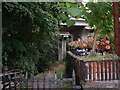
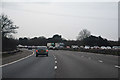
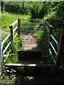
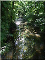
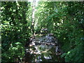
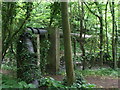
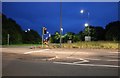
Photos of BS16 6JY

Area Information
BS16 6JY is a small, tightly knit postcode area in South Gloucestershire, encompassing parts of Winterbourne, Frenchay, and Hambrook. With a population of 1,834 and a density of 488 people per square kilometre, it reflects a compact residential cluster where historical and modern elements coexist. The area is traversed by the M4 motorway, a key artery connecting Bristol to the wider South West, though the village itself retains a rural character with arable farmland and deciduous woodlands. Winterbourne’s history stretches back to Roman times, with traces of ancient roads and settlements still visible. Today, the area is defined by its parish church of St Michael the Archangel, a 12th-century building that has stood as a community anchor for centuries. Daily life here balances proximity to urban infrastructure with a slower pace, offering residents access to nearby schools, transport links, and a mix of local amenities. The presence of historic sites like the Friends Meeting House in Frenchay and the 18th-century St Michael’s School adds cultural depth, while the surrounding landscape provides a quiet counterpoint to the area’s connectivity.
- Area Type
- Postcode
- Area Size
- Not available
- Population
- 1834
- Population Density
- 488 people/km²
The property market in BS16 6JY is characterised by a high rate of home ownership (78%) and a predominance of houses as the primary accommodation type. This indicates a market skewed towards owner-occupation rather than rental properties, which is typical of smaller, established communities. The presence of houses suggests a mix of larger properties, potentially offering more space than flats or apartments. Given the area’s small size and the density of 488 people per square kilometre, the housing stock is likely limited, meaning buyers may need to consider nearby areas for more options. The stability of home ownership and the focus on houses reflect a community that values long-term residency and property investment. For buyers, this means a market with fewer speculative properties but potentially higher demand from local families seeking established homes.
House Prices in BS16 6JY
No properties found in this postcode.
Energy Efficiency in BS16 6JY
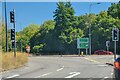
The lifestyle in BS16 6JY is shaped by its proximity to a range of amenities, from retail to transport. Local shops include Sainsburys Bristol, Co-op Downend, and Morrisons Daily, offering everyday essentials. The area’s rail network, with stations like Patchway and Filton Abbey Wood, provides easy access to Bristol and beyond, while the nearby Bristol Filton Airport caters to regional travel needs. Ferries at Netham Lock and St Philip’s Bridge add convenience for those near waterways. The presence of two metro stations, Oldland and Bitton, further expands mobility. These amenities support a practical, connected lifestyle, allowing residents to blend local convenience with broader opportunities. The area’s historical and natural features, such as the parish church and surrounding woodlands, complement its modern infrastructure, creating a balanced environment for daily life.
Amenities
Schools
The schools near BS16 6JY include Frenchay Church of England Primary School, which holds a ‘good’ Ofsted rating, and Frenchay Park Hospital School, a special needs institution. Additional education services are provided by the South Gloucestershire Hospital Home Teaching Service and the Avon Hospital Education Service, which cater to specific educational needs. The mix of school types offers families a range of options, from mainstream primary education to specialist support for students with complex requirements. While there is no secondary school listed, the proximity to hospital-based education services suggests the area is well-served for those requiring tailored learning environments. Families should consider the specific needs of their children when evaluating the school landscape, as the availability of special schools and hospital-linked services may be critical for some households.
| Rank | School | Type | Entry gender | Ages |
|---|
Explore more schools in this area
Go to Schools tabDemographics
The population of BS16 6JY is predominantly middle-aged, with a median age of 47 and the most common age range being adults aged 30–64. This suggests a community with established households and a strong presence of families. Home ownership is high, at 78%, indicating a stable residential base with long-term residents. The accommodation type is primarily houses, reflecting a suburban or semi-rural setting rather than high-density housing. The predominant ethnic group is White, with no specific data on other demographics provided. The age profile and ownership rates imply a mature, settled community with fewer transient residents. While the data does not specify deprivation levels, the high home ownership and moderate population density suggest a relatively stable quality of life, though the median age may mean a smaller proportion of younger families compared to other areas.
Household Size
Accommodation Type
Tenure
Ethnic Group
Religion
Household Composition
Age
Household Deprivation
NS-SEC
Explore more demographic insights in this area
Go to Demographics tabPlanning
Planning Constraints
- Flood RiskPremium
- Ramsar Wetland SitesPremium
- Area of Outstanding Natural BeautyPremium
- Protected Nature ReservePremium
- Protected WoodlandPremium