Area Overview for BS16 5UQ
Photos of BS16 5UQ
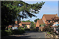
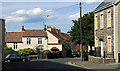
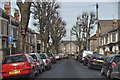
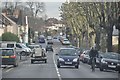
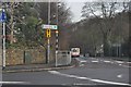
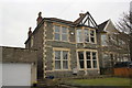
18 photos from this area
Area Information
Key information about the BS16 5UQ including its size, population, and administrative classification.
- Area Type
- Postcode
- Area Size
- 1.1 hectares
- Population
- Not available
- Population Density
- Not available
House Prices in BS16 5UQ
18
Properties
£229,227
Average Sold Price
£51,000
Lowest Price
£330,000
Highest Price
Showing 18 properties
| Address | Type | Beds | Baths | Last Sale Price | Last Sale Date | |
|---|---|---|---|---|---|---|
| 13 Lodge Walk, Downend, BS16 5UQ | Detached | 3 | 1 | £290,000 | Dec 2024 | |
| 6 Lodge Walk, Downend, BS16 5UQ | Terraced | 2 | 1 | £282,000 | Dec 2023 | |
| 2 Lodge Walk, Downend, BS16 5UQ | house | - | - | £280,000 | Feb 2022 | |
| 7 Lodge Walk, Downend, BS16 5UQ | Terraced | 3 | 2 | £256,000 | May 2019 | |
| 12 Lodge Walk, Downend, BS16 5UQ | Terraced | 3 | - | £240,000 | Sep 2018 | |
| 17 Lodge Walk, Downend, BS16 5UQ | Terraced | 5 | 2 | £330,000 | Sep 2017 | |
| 8 Lodge Walk, Downend, BS16 5UQ | house | - | - | £312,500 | Nov 2015 | |
| 4 Lodge Walk, Downend, BS16 5UQ | Terraced | 3 | 1 | £149,000 | Nov 2012 | |
| 1 Lodge Walk, Downend, BS16 5UQ | house | 5 | - | £155,000 | Dec 2011 | |
| 3 Lodge Walk, Downend, BS16 5UQ | house | - | - | £176,000 | Nov 2011 |
Page 1 of 2
Energy Efficiency in BS16 5UQ
Amenities
Schools
| Rank | School | Type | Entry gender | Ages |
|---|
Explore more schools in this area
Go to Schools tabDemographics
Household Size
One person
most common
Accommodation Type
Houses
most common
Tenure
73
majority
Ethnic Group
White
most common
Religion
N/A
most common
Household Composition
N/A
most common
Age
47
median
Adults (30-64 years)
most common
Household Deprivation
N/A
with no deprivation
NS-SEC
39
in Lower managerial occupations
Explore more demographic insights in this area
Go to Demographics tabPlanning
Planning Constraints
- Flood RiskPremium
- Ramsar Wetland SitesPremium
- Area of Outstanding Natural BeautyPremium
- Protected Nature ReservePremium
- Protected WoodlandPremium