Area Overview for BS16 5EB
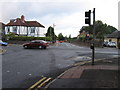
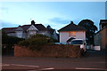
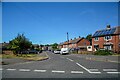
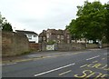
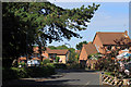
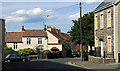
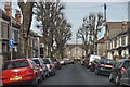
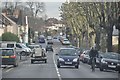
Photos of BS16 5EB
Area Information
BS16 5EB represents a specific residential cluster situated within the broader Downend and Bromley Heath civil parish in South Gloucestershire. This small postcode area spans just 5029 square metres and houses a population of 1573 people. Residents live in a predominantly suburban setting that has evolved from its rural agricultural roots over the last century. The area was once part of Kingswood Forest, covering farmland and quarries until enclosure in the late eighteenth century. Housing developments expanded significantly between the 1930s and 1960s, transforming the landscape from open fields to a thriving community. You are centrally located near the M4 motorway and the ring road, which define the modern bounds of the neighbourhood. The settlement retains historic elements alongside modern infrastructure, creating a distinct local identity. Living in BS16 5EB means being part of a defined residential pocket that blends post-war suburbia with older village character. The coordinates 51.485271, -2.513842 pinpoint the exact centre of this postcode block within the larger parish structure. The small size of the area suggests a tight-knit community where daily life revolves around local streets and immediate surroundings.
- Area Type
- Postcode
- Area Size
- 5029 m²
- Population
- Not available
- Population Density
- Not available
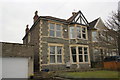
BS16 5EB is characterised almost entirely by houses, as indicated by the accommodation type data. This housing stock contrasts with nearby towns that might offer a mix of purpose-built blocks and detached homes. With 74 per cent of residents owning their homes, the market is heavily skewed towards owner-occupation rather than rentals. You will find that the majority of properties here are expected to be residential homes rather than investment flats or student accommodations. The small area size of 5029 square metres means the housing stock is compact and likely consists of detached or semi-detached family properties. The population of 1573 indicates a limited inventory of homes within this specific postcode boundary. While the data does not list specific property prices or sale volumes, the high ownership rate implies stability in the local market. Buyers seeking entry-level homes in this cluster might find limited options due to the small number of addresses. The dominance of houses suggests that if you are looking for a single-family dwelling, this area meets your core requirement for space and layout. The lack of apartment blocks or high-density blocks further confirms a low-density suburban environment.
House Prices in BS16 5EB
Showing 10 properties
| Address | Type | Beds | Baths | Last Sale Price | Last Sale Date | |
|---|---|---|---|---|---|---|
| 174 Downend Road, Downend, BS16 5EB | Terraced | 4 | 2 | £475,000 | Aug 2025 | |
| 172 Downend Road, Downend, BS16 5EB | Terraced | 4 | 2 | £450,000 | Jan 2025 | |
| 184 Downend Road, Downend, BS16 5EB | Terraced | 4 | 2 | £437,175 | Aug 2024 | |
| 188 Downend Road, Downend, BS16 5EB | Terraced | 4 | 1 | £237,500 | Jul 2017 | |
| 190A Downend Road, Downend, BS16 5EB | Terraced | 4 | 1 | £120,000 | Jan 2006 | |
| 176 Downend Road, Downend, BS16 5EB | Detached | 1 | 2 | £45,000 | Oct 1998 | |
| 180 Downend Road, Downend, BS16 5EB | Detached | 1 | 2 | £57,500 | Jan 1998 | |
| 186 Downend Road, Downend, BS16 5EB | Terraced | 4 | 2 | - | - | |
| 178 Downend Road, Downend, BS16 5EB | house | 5 | - | - | - | |
| 182 Downend Road, Downend, BS16 5EB | house | - | - | - | - |
Energy Efficiency in BS16 5EB
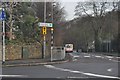
Daily life in BS16 5EB is supported by a variety of amenities within practical reach. Residents have access to five retail outlets, including Morrisons Daily, Co-op Straits, and Co-op Downend. These local shops provide essential grocery supplies and daily necessities without the need for long journeys. Transport connectivity is further enhanced by five nearby ferry terminals, including Netham Lock Ferry Terminal, Temple Meads Station Ferry Landing, and St Philip's Bridge. Additionally, you are close to two metro services at Oldland and Bitton, alongside five available rail connections. One airport, Bristol Filton Airport, is nearby for those requiring private or business flights. The area sits within South Gloucestershire, offering a mix of suburban convenience and regional access. The combination of local supermarkets and major transport nodes ensures that your routine errands and longer trips are easily managed. Bicyles and walking can take you to the nearest shops, while cars provide rapid access to airports and railway stations. The presence of multiple food retailers means you do not need to travel far for fresh produce or household stocks.
Amenities
Schools
Families living in BS16 5EB have access to specific educational facilities, though the local offerings are limited within the immediate postcode. The primary educational institution nearby is Pathways Learning Centre, which serves as a learning resource for the community. The available data lists this school as being in the ‘other’ category rather than a standard comprehensive or primary school designation. There are no secondary schools or primary academies listed directly within the immediate vicinity of this specific postcode. This situation requires families to look beyond BS16 5EB boundaries for mainstream education options. The presence of Pathways Learning Centre suggests a focus on adult learning or alternative education routes rather than compulsory schooling for young children. Residents cannot rely on multiple educational institutions within walking distance, so travel times to main schools in Downend or the wider parish will vary. You should investigate transport options to schools outside this small residential cluster if you have school-aged children. The lack of diverse school types in the direct neighbourhood data reflects the small population size of just 1573 people.
| Rank | School | Type | Entry gender | Ages |
|---|
Explore more schools in this area
Go to Schools tabDemographics
The community in BS16 5EB is defined by an older demographic profile with a median age of 47 years. The most common age range among residents is adults aged between 30 and 64 years. This data indicates a neighbourhood largely occupied by established families and individuals settled through their mid-adulthood. Home ownership stands at 74 per cent of households, suggesting a stable area where residents have a long-term presence rather than a transient tenant population. The accommodation type for this postcode is exclusively houses, distinguishing it from urban zones dominated by flats or apartments. The predominant ethnic group is White, reflecting the historical settlement patterns of the region. There are no separate statistics for deprivation levels provided in the available research, so the focus remains on ownership and age. The high percentage of home ownership aligns with the suburban nature of the housing stock, where people have purchased properties rather than rented them. This profile supports a view of the area as a long-term home for mature residents who have built their lives around the local streets.
Household Size
Accommodation Type
Tenure
Ethnic Group
Religion
Household Composition
Age
Household Deprivation
NS-SEC
Explore more demographic insights in this area
Go to Demographics tabPlanning
Planning Constraints
- Flood RiskPremium
- Ramsar Wetland SitesPremium
- Area of Outstanding Natural BeautyPremium
- Protected Nature ReservePremium
- Protected WoodlandPremium