Area Overview for BS16 5BD
Photos of BS16 5BD
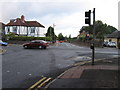
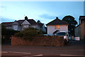
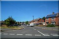
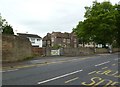
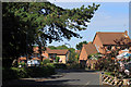
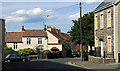
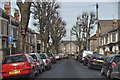

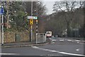
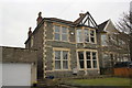

18 photos from this area
Area Information
Key information about the BS16 5BD including its size, population, and administrative classification.
- Area Type
- Postcode
- Area Size
- 5989 m²
- Population
- Not available
- Population Density
- Not available
House Prices in BS16 5BD
14
Properties
£441,500
Average Sold Price
£225,000
Lowest Price
£785,000
Highest Price
Showing 14 properties
| Address | Type | Beds | Baths | Last Sale Price | Last Sale Date | |
|---|---|---|---|---|---|---|
| 105 Downend Road, Fishponds, Bristol, BS16 5BD | Semi-detached | 3 | 1 | £425,000 | Jan 2022 | |
| Whitelodge Care Home, 101 Downend Road, Fishponds, Bristol, BS16 5BD | Detached | 4 | 2 | £785,000 | Dec 2020 | |
| 71 Downend Road, Fishponds, Bristol, BS16 5BD | Semi-detached | 3 | 1 | £450,000 | Jun 2018 | |
| 69A Downend Road, Fishponds, Bristol, BS16 5BD | Detached | 3 | 2 | £470,000 | Oct 2017 | |
| 73 Downend Road, Fishponds, Bristol, BS16 5BD | Flat | - | 1 | £225,000 | Dec 2004 | |
| 67 Downend Road, Fishponds, Bristol, BS16 5BD | Semi-detached | - | - | £294,000 | Nov 2003 | |
| 103 Downend Road, Fishponds, Bristol, BS16 5BD | Detached | - | - | - | - | |
| 107 Downend Road, Fishponds, Bristol, BS16 5BD | Semi-detached | - | - | - | - | |
| 75 Downend Road, Fishponds, Bristol, BS16 5BD | Flat | 1 | 1 | - | - | |
| Second Floor Flat, 69 Downend Road, Fishponds, Bristol, BS16 5BD | Flat | - | - | - | - |
Page 1 of 2
Energy Efficiency in BS16 5BD
Amenities
Schools
| Rank | School | Type | Entry gender | Ages |
|---|
Explore more schools in this area
Go to Schools tabDemographics
Household Size
Two person
most common
Accommodation Type
Houses
most common
Tenure
77
majority
Ethnic Group
White
most common
Religion
N/A
most common
Household Composition
N/A
most common
Age
47
median
Adults (30-64 years)
most common
Household Deprivation
N/A
with no deprivation
NS-SEC
35
in Lower managerial occupations
Explore more demographic insights in this area
Go to Demographics tabPlanning
Planning Constraints
- Flood RiskPremium
- Ramsar Wetland SitesPremium
- Area of Outstanding Natural BeautyPremium
- Protected Nature ReservePremium
- Protected WoodlandPremium