Area Overview for BS16 5AG
Photos of BS16 5AG


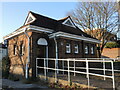
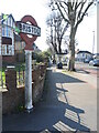
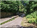


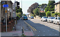
30 photos from this area
Area Information
Key information about the BS16 5AG including its size, population, and administrative classification.
- Area Type
- Postcode
- Area Size
- 2019 m²
- Population
- Not available
- Population Density
- Not available
House Prices in BS16 5AG
13
Properties
£251,500
Average Sold Price
£179,500
Lowest Price
£315,000
Highest Price
Showing 13 properties
| Address | Type | Beds | Baths | Last Sale Price | Last Sale Date | |
|---|---|---|---|---|---|---|
| 133 Staple Hill Road, Fishponds, Bristol, BS16 5AG | Detached | 5 | 2 | £315,000 | Jan 2021 | |
| 135 Staple Hill Road, Fishponds, Bristol, BS16 5AG | Terraced | 3 | - | £260,000 | Jan 2016 | |
| 139 Staple Hill Road, Fishponds, Bristol, BS16 5AG | house | - | - | £179,500 | Nov 2007 | |
| 131 Staple Hill Road, Fishponds, Bristol, BS16 5AG | Flat | 1 | 3 | - | - | |
| 137 Staple Hill Road, Fishponds, Bristol, BS16 5AG | house | - | - | - | - | |
| First Floor Flat, 143 Staple Hill Road, Fishponds, Bristol, BS16 5AG | Maisonette | - | - | - | - | |
| Basement Flat, 143 Staple Hill Road, Fishponds, Bristol, BS16 5AG | Flat | - | - | - | - | |
| Ground Floor Flat, 143 Staple Hill Road, Fishponds, Bristol, BS16 5AG | house | - | - | - | - | |
| First Floor Flat, 145 Staple Hill Road, Fishponds, Bristol, BS16 5AG | Flat | - | - | - | - | |
| Garden Flat, 141 Staple Hill Road, Fishponds, Bristol, BS16 5AG | Flat | - | - | - | - |
Page 1 of 2
Energy Efficiency in BS16 5AG
Amenities
Schools
| Rank | School | Type | Entry gender | Ages |
|---|
Explore more schools in this area
Go to Schools tabDemographics
Household Size
Two person
most common
Accommodation Type
Houses
most common
Tenure
77
majority
Ethnic Group
White
most common
Religion
N/A
most common
Household Composition
N/A
most common
Age
47
median
Adults (30-64 years)
most common
Household Deprivation
N/A
with no deprivation
NS-SEC
35
in Lower managerial occupations
Explore more demographic insights in this area
Go to Demographics tabPlanning
Planning Constraints
- Flood RiskPremium
- Ramsar Wetland SitesPremium
- Area of Outstanding Natural BeautyPremium
- Protected Nature ReservePremium
- Protected WoodlandPremium