Area Overview for BS16 3UT
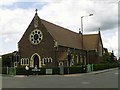
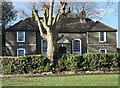
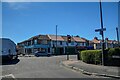
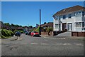
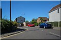
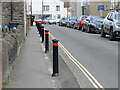
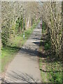
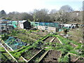
Photos of BS16 3UT
Area Information
BS16 3UT is a small residential postcode area in northeast Bristol, nestled within the Frome Vale electoral ward. With a population of 2,360, it is a compact community defined by its proximity to the River Frome and the Bristol and Bath Cycle Path. This area is part of a broader urban fabric in Bristol, yet retains a distinct character shaped by its natural surroundings and historical context. The River Frome, which flows through the ward, offers a scenic backdrop and potential for outdoor recreation. The area is served by multiple railway stations, including Stapleton Road and Ashley Down, providing easy access to central Bristol and beyond. While the population is relatively small, the area’s connectivity to transport networks and amenities makes it a practical choice for those seeking a balance between suburban tranquillity and urban convenience. The presence of both primary and secondary schools within proximity ensures families have educational options, while the predominance of houses over flats suggests a focus on family-oriented living.
- Area Type
- Postcode
- Area Size
- Not available
- Population
- Not available
- Population Density
- Not available
The property market in BS16 3UT is dominated by owner-occupied homes, with 58% of properties owned by residents rather than rented. This contrasts with areas where rental demand drives market dynamics, suggesting a more static housing stock. The predominance of houses over flats indicates a focus on family homes, likely with larger gardens or more spacious layouts. Given the small size of the postcode area, the housing stock is limited, which may mean competition for properties is higher. Buyers should consider the practical implications of this: the area is not a hotspot for speculative investment but suits those seeking a long-term residence. The lack of high-rise or purpose-built rental properties means the market is more aligned with traditional home ownership, with fewer short-term lettings. For those prioritising proximity to transport and amenities, the compact nature of the area ensures that properties are within easy reach of key services.
House Prices in BS16 3UT
No properties found in this postcode.
Energy Efficiency in BS16 3UT
The lifestyle in BS16 3UT is shaped by its proximity to retail, transport, and leisure facilities. Nearby shops include Lidl Fishponds, Morrisons Fishponds, and Sainsburys Bristol, offering everyday essentials within walking or short driving distance. The area’s rail network, with stations like Stapleton Road and Ashley Down, provides easy access to city centre hubs for shopping, dining, and entertainment. Ferry terminals such as Netham Lock and St Philip’s Bridge add to the transport options, while Bristol Filton Airport serves those requiring air travel. The River Frome and cycle paths offer recreational opportunities, and the compact size of the area ensures amenities are within practical reach. This mix of retail, transport, and natural features creates a convenient, though modest, lifestyle that prioritises accessibility over sprawling urban sprawl.
Amenities
Schools
Residents of BS16 3UT have access to a range of educational institutions. The College of St Matthia’s Infant School is a primary school, providing early education for younger children. Steiner Academy Bristol is an academy school, offering a specific educational philosophy. Avanti Gardens School, also an academy, holds an Ofsted rating of ‘good’, indicating a satisfactory standard of education. The mix of school types allows families to choose between traditional state education and alternative approaches. For parents seeking a ‘good’-rated school, Avanti Gardens School is a notable option. The presence of multiple schools within the area ensures that children have access to education without long commutes. However, the absence of secondary schools in the immediate vicinity may require families to consider nearby wards for comprehensive schooling.
| Rank | School | Type | Entry gender | Ages |
|---|
Explore more schools in this area
Go to Schools tabDemographics
The community in BS16 3UT is predominantly composed of adults aged 30–64, with a median age of 47. This suggests a mature population, likely with established careers and family commitments. Home ownership is high at 58%, indicating a stable housing market where many residents are long-term occupants. The area is characterised by houses rather than flats, reflecting a preference for larger, more private properties. The predominant ethnic group is White, though no specific data on diversity or deprivation is provided. The age profile and ownership figures suggest a community that is relatively settled, with limited turnover in housing. For buyers, this implies a neighbourhood where property values may be stable but not rapidly appreciating. The absence of specific data on deprivation means that quality of life factors such as access to services and infrastructure must be assessed through other metrics, such as proximity to schools and transport links.
Household Size
Accommodation Type
Tenure
Ethnic Group
Religion
Household Composition
Age
Household Deprivation
NS-SEC
Explore more demographic insights in this area
Go to Demographics tabPlanning
Planning Constraints
- Flood RiskPremium
- Ramsar Wetland SitesPremium
- Area of Outstanding Natural BeautyPremium
- Protected Nature ReservePremium
- Protected WoodlandPremium