Area Overview for BS16 3JF
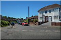
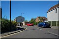
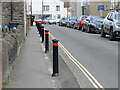
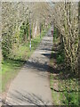
Photos of BS16 3JF
Area Information
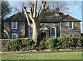
Residing in BS16 3JF means living within Hillfields, a historic ward on the outskirts of Fishponds in north-east Bristol. This small residential cluster spans just 3,445 m² and supports a population of 1,784 people. The area stands as one of Bristol's earliest council housing estates, originally developed under the National Housing Scheme from 1919 to 1920. Architects designed these inter-war homes using fourteen different competition styles, creating a streetscape defined by curving roads and abundant greenery. You are situated on the north side of Lodge Causeway, in a zone defined by its pioneering social history and quiet domestic character. The estate was part of a 'demonstration area' visited by international delegates when it first opened on Beechen Drive in 1920. Today, the postcodes in this district reflect a neighbourhood that values its architectural heritage. Living in BS16 3JF offers a connection to Bristol's property history, with the area celebrating its 101st anniversary of development in 2020. The compact size of the postcode area suggests a tight-knit community environment where the built fabric remains largely intact from its original construction.
- Area Type
- Postcode
- Area Size
- 3445 m²
- Population
- Not available
- Population Density
- Not available
The housing stock in BS16 3JF is overwhelmingly dominated by houses, reflecting the area's origins as a purpose-built council estate. With 66% home ownership, the market functions primarily for sellers and buyers rather than landlords and tenants. This high retention rate indicates that properties change hands less frequently than in predominantly rental zones. Buyers looking at homes in BS16 3JF will find a stock of architecturally varied inter-war homes, built between 1919 and 1920 using designs from a competitive panel of architects. The estate includes detached bungalows and semi-detached properties arranged along curving streets, a layout typical of the 'Homes for Heroes' initiative. Your purchase here is likely to involve a family home rather than a flat or apartment. The specific nature of the postcode, covering a small residential cluster, means that new developments are limited. Instead, you are buying into a protected historic environment where the original layouts remain intact. This ownership pattern suggests a community where residents prefer to stay rather than move, potentially slowing turnover rates and stabilising the local market.
House Prices in BS16 3JF
Showing 14 properties
| Address | Type | Beds | Baths | Last Sale Price | Last Sale Date | |
|---|---|---|---|---|---|---|
| 3 Parnall Road, Fishponds, Bristol, BS16 3JF | Terraced | 2 | 1 | £380,000 | Jul 2024 | |
| 5 Parnall Road, Fishponds, Bristol, BS16 3JF | Terraced | 3 | 2 | £385,000 | Sep 2023 | |
| 19 Parnall Road, Fishponds, Bristol, BS16 3JF | house | - | - | £232,000 | Feb 2019 | |
| 13 Parnall Road, Fishponds, Bristol, BS16 3JF | Terraced | 3 | 1 | £245,000 | Sep 2017 | |
| 15 Parnall Road, Fishponds, Bristol, BS16 3JF | house | - | - | £159,000 | Jul 2011 | |
| 9 Parnall Road, Fishponds, Bristol, BS16 3JF | house | - | - | £155,000 | Apr 2009 | |
| 17 Parnall Road, Fishponds, Bristol, BS16 3JF | Terraced | - | - | £131,000 | Jun 2004 | |
| 7 Parnall Road, Fishponds, Bristol, BS16 3JF | Terraced | - | - | £98,450 | Jun 2002 | |
| Flat 2, 21 Parnall Road, Fishponds, Bristol, BS16 3JF | Flat | 2 | 1 | - | - | |
| 11 Parnall Road, Fishponds, Bristol, BS16 3JF | Terraced | - | - | - | - |
Energy Efficiency in BS16 3JF
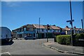
Daily life in BS16 3JF involves easy access to a range of commercial and leisure facilities just outside the estate boundaries. Residents regularly visit Aldi, Morrisons, and Lidl, which are all located near Fishponds. These three major retailers are listed as the notable amenities in the retail category, ensuring you have access to groceries and daily necessities. Five retail outlets exist within practical reach, offering a convenient selection for household shopping. Transport options further enhance your lifestyle with five railway stations, five ferry terminals, and two Metro stops nearby. You can catch trains at Stapleton Road, Lawrence Hill, or Ashley Down, or take ferries from Netham Lock or Temple Meads. The area is complemented by Bristol Filton Airport for air travel needs. While Hillfields Park was a notable feature of the original estate plan, the immediate amenity data focuses on commercial services. The presence of these five stores in the retail category means you do not need to travel far for weekly shopping. Living in BS16 3JF positions you close to Fishponds, allowing for a mix of suburban tranquility and proximity to essential services.
Amenities
Schools
Families living in BS16 3JF benefit from access to two primary schools within the immediate vicinity, both holding a 'good' Ofsted rating. Chester Park Infant School and Chester Park Junior School serve as the nearest educational institutions. These two facilities are designated as good, providing a standardised quality of education for children attending the estate. The schools are linked in name but operate as separate entities for primary education, with the infant school serving younger children and the junior school taking over for older pupils. This setup supports children from nursery age through to the end of primary education without requiring a transfer to a different institution. While the area research mentions Hillfields Park Infant School and Junior School from 1927 and 1929, the data provided lists Chester Park as the current rated option. Local history records Briarwood School on Briar Way as a specialist institution for students with severe learning difficulties. For standard primary education, the presence of two good-rated schools near the estate provides a solid option for families settling in the area. Schools near BS16 3JF are integral to the daily routine of residents who prioritise educational stability.
| Rank | School | Type | Entry gender | Ages |
|---|
Explore more schools in this area
Go to Schools tabDemographics
The community in BS16 3JF reflects a mature demographic profile with a median age of 47 years. Residents are primarily adults between the ages of 30 and 64, indicating a neighbourhood established by long-term owners rather than transient renters. Home ownership is strong, with 66% of households owning their properties outright or with a mortgage. This high level of ownership aligns with the accommodation type, as the area consists almost exclusively of houses. The population density reaches 517,894 people per km² within this specific postcode boundary, yet the overall character remains that of a low-density garden suburb rather than a high-rise urban block. White residents form the predominant ethnic group, consistent with the estate's development as part of the inter-war council housing initiative. This age structure suggests families with grown children or empty-nesters reside in the bungalows and semi-detached homes on the estate. The data points to a stable community where residents have deep roots in the local infrastructure. You will find a population that has settled into the rhythms of this historic garden suburb, valuing the security of tenure and the privacy of detached or semi-detached living arrangements.
Household Size
Accommodation Type
Tenure
Ethnic Group
Religion
Household Composition
Age
Household Deprivation
NS-SEC
Explore more demographic insights in this area
Go to Demographics tabPlanning
Planning Constraints
- Flood RiskPremium
- Ramsar Wetland SitesPremium
- Area of Outstanding Natural BeautyPremium
- Protected Nature ReservePremium
- Protected WoodlandPremium