Area Overview for BS16 3AD
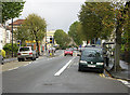
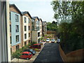
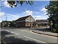
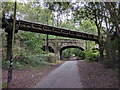
Photos of BS16 3AD

Area Information
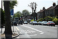
BS16 3AD is a small residential postcode in England, encompassing a compact cluster of homes in the North East of Bristol. With a population of just over 2,000, it reflects a tight-knit community rooted in the historic Eastville district. The area’s character is shaped by its Victorian-era parks, such as Eastville Park, which offers green space amid the urban fabric. Originally a working-class district, it retains echoes of its past through sites like the former Eastville Workhouse, now replaced by housing. The median age of 47 suggests a mature population, with many residents aged 30–64. This is a place where history meets practical living, with homes predominantly in the private sector. Daily life here balances proximity to transport networks—rail, ferry, and metro—with the convenience of nearby retail and amenities. While the area lacks high-end amenities, its accessibility to Bristol’s broader infrastructure makes it appealing for those prioritising connectivity over luxury. The population is largely White, with home ownership at 49%, indicating a mix of owner-occupied and rental properties. For buyers, BS16 3AD offers a quiet, historically rich setting, though its small size means limited housing stock.
- Area Type
- Postcode
- Area Size
- Not available
- Population
- Not available
- Population Density
- Not available
The property market in BS16 3AD is defined by its small size and predominantly owner-occupied homes. With 49% of residents owning their properties, the area leans more towards private ownership than rental markets, though the relatively low home ownership rate indicates a significant portion of the housing stock is let. The accommodation type is houses, which are typically larger and more suited to families than flats. This suggests a market where buyers may find established, traditional homes rather than modern developments. The limited scale of the area means housing stock is constrained, which could make the market competitive for buyers. For those seeking investment, the mix of owner-occupied and rental properties may offer opportunities, but the small size of the postcode means the immediate surroundings are critical for finding additional options. The presence of nearby amenities like retail and transport links could enhance the appeal of properties here, though buyers should consider the area’s historical character and limited expansion potential.
House Prices in BS16 3AD
No properties found in this postcode.
Energy Efficiency in BS16 3AD
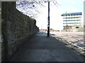
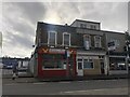
Living in BS16 3AD offers access to a range of amenities within practical reach. Retail options include Aldi, Iceland, and Morrisons at Fishponds, providing everyday shopping convenience. The area’s transport links—rail, ferry, and metro—allow residents to access Bristol’s broader services, including the city’s cultural and commercial hubs. Eastville Park, a historic green space, offers recreational opportunities, while the nearby Greenbank Cemetery and former Eastville Stadium site add a layer of historical interest. The presence of multiple railway stations and ferry terminals enhances the area’s connectivity, making it easy to commute or travel. For those seeking a balance between practicality and historical character, BS16 3AD provides a mix of modern retail, transport, and green space. The compact nature of the area means amenities are concentrated, requiring residents to navigate a short distance for most services.
Amenities
Schools
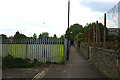
The nearest schools to BS16 3AD include St Matthias Park Pupil Referral Service and St Matthias Academy, both categorised as "other" in the data. Neither school’s Ofsted rating is provided, so their performance cannot be assessed here. The inclusion of a pupil referral service suggests the area may cater to students with specific educational needs, while St Matthias Academy likely serves a broader population. Families seeking a range of school types may find this mix useful, though the absence of primary or secondary school ratings limits detailed evaluation. The proximity of these institutions to the area indicates accessibility for residents, but the types of schools listed do not provide a full picture of educational options. Buyers considering the area should investigate further to understand the quality and suitability of these schools for their children’s needs.
| Rank | School | Type | Entry gender | Ages |
|---|
Explore more schools in this area
Go to Schools tabDemographics
The residents of BS16 3AD are predominantly adults aged 30–64, with a median age of 47. This suggests a community of middle-aged individuals, likely established in their careers and families. Home ownership stands at 49%, meaning nearly half of residents live in properties they own, while the remainder are likely renters. The area is characterised by houses rather than flats, reflecting a traditional housing stock suited to families. The predominant ethnic group is White, though no data is provided on other ethnicities. The age profile indicates a population that may be less transient, with fewer young families or retirees compared to other areas. The lack of specific data on deprivation means the quality of life cannot be assessed in this context, but the demographic mix suggests a stable, working-age population. The presence of schools and transport links implies a focus on practical living over niche demographics. For buyers, the age profile and home ownership rate suggest a community that values stability and proximity to services.
Household Size
Accommodation Type
Tenure
Ethnic Group
Religion
Household Composition
Age
Household Deprivation
NS-SEC
Explore more demographic insights in this area
Go to Demographics tabPlanning
Planning Constraints
- Flood RiskPremium
- Ramsar Wetland SitesPremium
- Area of Outstanding Natural BeautyPremium
- Protected Nature ReservePremium
- Protected WoodlandPremium