Area Overview for BS16 2UL
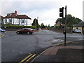
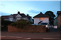
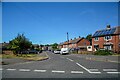
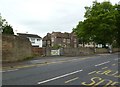
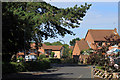
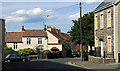
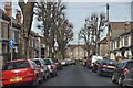
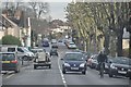
Photos of BS16 2UL
Area Information
BS16 2UL lies within the Frome Vale ward in northeast Bristol, a small residential cluster near the River Frome. With a population of 1,944, this area blends suburban tranquillity with proximity to urban amenities. The River Frome runs through the ward, offering natural scenery and access to the Bristol and Bath Cycle Path, a key route for cyclists. The postcode is part of a historically significant region, reflected in its archival records and local heritage. Daily life here is shaped by its compact size, with residents enjoying a mix of local shops, transport links, and nearby green spaces. The area’s character is defined by its older housing stock, predominantly owner-occupied homes, and a community skewed toward adults aged 30–64. While small, BS16 2UL is well-connected to Bristol’s transport network, including rail stations and ferry terminals, making it a practical choice for commuters. Its low crime rates and minimal environmental risks further enhance its appeal for those seeking a balanced lifestyle.
- Area Type
- Postcode
- Area Size
- Not available
- Population
- Not available
- Population Density
- Not available
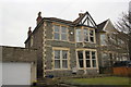
BS16 2UL is predominantly an owner-occupied area, with 77% of homes owned by residents rather than rented. The accommodation type is largely houses, which is unusual in modern housing markets where flats are more common. This suggests a mix of family homes and older properties, reflecting the area’s historical character. Given the small size of the postcode and the focus on houses, the housing stock is likely limited, making it a niche market for buyers seeking traditional homes. The high home ownership rate indicates a stable community with long-term residents, which may influence property values and availability. For buyers, this means fewer rental options and a focus on purchasing rather than leasing. The proximity to transport links and amenities may also make it attractive to those prioritising location over property size.
House Prices in BS16 2UL
No properties found in this postcode.
Energy Efficiency in BS16 2UL
Living in BS16 2UL offers access to a range of amenities within practical reach. Retail options include Morrisons Daily, Co-op Downend, and other local stores, ensuring everyday shopping needs are met. The area’s proximity to rail stations, ferry terminals, and metro links facilitates easy travel for work, leisure, or commuting. The River Frome and Bristol and Bath Cycle Path provide opportunities for outdoor activities, adding to the area’s appeal. While specific parks or leisure venues are not listed, the nearby transport hubs and retail centres suggest a lifestyle balanced between convenience and accessibility. The presence of multiple rail and ferry options also supports a dynamic social life, with easy access to cultural and recreational opportunities in Bristol.
Amenities
Schools
The nearest school to BS16 2UL is Gracefield Preparatory School, an independent institution. While no Ofsted rating is provided, the presence of an independent school suggests a focus on private education for families in the area. The lack of state schools in the data means residents may need to look beyond the immediate postcode for secondary education options. The school’s existence indicates that the area attracts families prioritising independent schooling, though it may not cater to all educational needs. For those requiring state-funded education, nearby wards or Bristol’s broader network would need to be considered. The absence of additional schools in the data highlights the limited local provision, which could be a factor for prospective buyers.
| Rank | School | Type | Entry gender | Ages |
|---|
Explore more schools in this area
Go to Schools tabDemographics
The population of BS16 2UL is 1,944, with a median age of 47, indicating a mature community. The most common age range is adults aged 30–64, suggesting a stable, family-oriented demographic. Home ownership is high at 77%, with houses being the predominant accommodation type. This reflects a residential area where long-term residency is common. The predominant ethnic group is White, aligning with broader regional trends. The absence of specific data on deprivation means the area’s quality of life can be inferred from its low crime score (77/100) and minimal environmental risks. The age profile suggests a community with established careers and family life, likely contributing to a quiet, low-traffic environment. The high home ownership rate also implies a sense of permanence, with fewer rental properties compared to other areas.
Household Size
Accommodation Type
Tenure
Ethnic Group
Religion
Household Composition
Age
Household Deprivation
NS-SEC
Explore more demographic insights in this area
Go to Demographics tabPlanning
Planning Constraints
- Flood RiskPremium
- Ramsar Wetland SitesPremium
- Area of Outstanding Natural BeautyPremium
- Protected Nature ReservePremium
- Protected WoodlandPremium