Area Overview for BS16 2QG
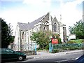
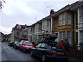
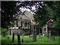
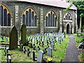
Photos of BS16 2QG
Area Information
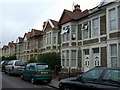
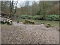
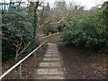
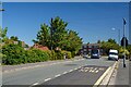
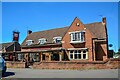
Living in BS16 2QG means being part of a small, tightly knit residential cluster in northeast Bristol, within the Frome Vale electoral ward. The area is defined by its proximity to the River Frome, which flows through the region, and its connection to the Bristol and Bath Cycle Path, offering easy access to cycling routes. With a population of 1,722, it is a modest community that balances quiet living with practical connectivity. The area’s compact size means residents are close to local amenities, including retail, transport hubs, and green spaces. The median age of 47 suggests a mature demographic, with most residents aged between 30 and 64, creating a stable, family-oriented environment. While the area is small, its location near major transport arteries like Bristol Parkway Railway Station and nearby ferry terminals ensures it is well-served for commuting. The presence of houses as the primary accommodation type reflects a traditional, settled community, where home ownership rates stand at 58%, indicating a mix of long-term residents and those seeking a quieter alternative to city centres.
- Area Type
- Postcode
- Area Size
- Not available
- Population
- Not available
- Population Density
- Not available
The property market in BS16 2QG is characterised by a 58% home ownership rate, indicating that the area is primarily owner-occupied rather than a rental hotspot. The accommodation type is predominantly houses, which suggests a focus on traditional, family-friendly homes rather than apartments or flats. This makes the area appealing to those seeking space and a more suburban feel, though the small size of the postcode means housing stock is limited. Buyers should consider the proximity to transport links, including rail and ferry services, which enhance the area’s connectivity. The presence of houses also implies that properties may be larger and more spread out than in denser urban areas. However, the limited size of the postcode means that the immediate surroundings are key to assessing availability and potential for expansion.
House Prices in BS16 2QG
No properties found in this postcode.
Energy Efficiency in BS16 2QG
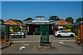
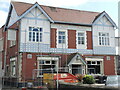
Residents of BS16 2QG have access to a range of amenities within easy reach. Retail options include Morrisons Daily, Co-op Straits, and Sainsburys Bristol, providing essential shopping for daily needs. The area’s proximity to the River Frome and the Bristol and Bath Cycle Path offers opportunities for outdoor recreation and leisure. Public transport is well-served by rail, ferry, and metro services, with stations like Oldland and Bitton adding to the connectivity. The presence of multiple transport hubs ensures that commuting and travel are convenient, while the cycle path caters to those preferring active transport. The mix of retail, transport, and green spaces contributes to a balanced lifestyle, blending practicality with recreational opportunities.
Amenities
Schools
The nearest school to BS16 2QG is Little Hayes Nursery School, which provides early education for young children. No primary or secondary schools are listed in the data, meaning families with older children may need to look further afield for schooling options. The nursery school’s presence is a practical benefit for parents, offering a local resource for pre-school education. However, the absence of higher-level schools suggests that the area is not a primary destination for families requiring comprehensive educational facilities. Residents may need to consider commuting to nearby towns or schools outside the immediate postcode for a full range of educational stages.
| Rank | School | Type | Entry gender | Ages |
|---|
Explore more schools in this area
Go to Schools tabDemographics
BS16 2QG has a median age of 47, with the majority of residents falling into the 30-64 age range. This suggests a mature, stable population, likely with established careers and families. Home ownership is at 58%, slightly above the national average, indicating a community where many residents have long-term ties to the area. The predominant accommodation type is houses, which aligns with the residential character of the postcode. The predominant ethnic group is White, reflecting the broader demographic patterns of the region. The population size of 1,722 means the area is small enough to foster a close-knit community but large enough to support essential services. The absence of specific deprivation data means no direct commentary on economic challenges, but the high home ownership and age profile suggest a relatively affluent, settled population.
Household Size
Accommodation Type
Tenure
Ethnic Group
Religion
Household Composition
Age
Household Deprivation
NS-SEC
Explore more demographic insights in this area
Go to Demographics tabPlanning
Planning Constraints
- Flood RiskPremium
- Ramsar Wetland SitesPremium
- Area of Outstanding Natural BeautyPremium
- Protected Nature ReservePremium
- Protected WoodlandPremium