Area Overview for BS16 2JT
Photos of BS16 2JT
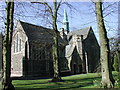
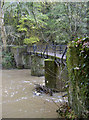
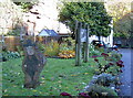
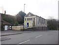
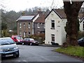
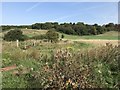
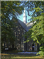
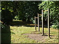
99 photos from this area
Area Information
Key information about the BS16 2JT including its size, population, and administrative classification.
- Area Type
- Postcode
- Area Size
- 5451 m²
- Population
- 2350
- Population Density
- 4192 people/km²
House Prices in BS16 2JT
20
Properties
£427,262
Average Sold Price
£385,000
Lowest Price
£475,000
Highest Price
Showing 20 properties
| Address | Type | Beds | Baths | Last Sale Price | Last Sale Date | |
|---|---|---|---|---|---|---|
| 20 Parklands, Fishponds, Bristol, BS16 2JT | Semi-detached | 3 | 3 | £420,000 | Aug 2024 | |
| 19 Parklands, Fishponds, Bristol, BS16 2JT | house | - | - | £419,950 | Jul 2023 | |
| 16 Parklands, Fishponds, Bristol, BS16 2JT | house | - | - | £432,500 | May 2023 | |
| 17 Parklands, Fishponds, Bristol, BS16 2JT | house | - | - | £449,000 | Mar 2023 | |
| 18 Parklands, Fishponds, Bristol, BS16 2JT | house | - | - | £475,000 | Mar 2023 | |
| 15 Parklands, Fishponds, Bristol, BS16 2JT | house | - | - | £475,000 | Feb 2023 | |
| 9 Parklands, Fishponds, Bristol, BS16 2JT | house | - | - | £435,000 | Jun 2022 | |
| 11 Parklands, Fishponds, Bristol, BS16 2JT | house | - | - | £438,000 | Jun 2022 | |
| 14 Parklands, Fishponds, Bristol, BS16 2JT | house | - | - | £430,000 | Jun 2022 | |
| 10 Parklands, Fishponds, Bristol, BS16 2JT | house | - | - | £435,000 | Jun 2022 |
Page 1 of 2
Energy Efficiency in BS16 2JT
Amenities
Schools
| Rank | School | Type | Entry gender | Ages |
|---|
Explore more schools in this area
Go to Schools tabDemographics
Household Size
One person
most common
Accommodation Type
Houses
most common
Tenure
59
majority
Ethnic Group
White
most common
Religion
N/A
most common
Household Composition
N/A
most common
Age
47
median
Adults (30-64 years)
most common
Household Deprivation
N/A
with no deprivation
NS-SEC
34
in Lower managerial occupations
Explore more demographic insights in this area
Go to Demographics tabPlanning
Planning Constraints
- Flood RiskPremium
- Ramsar Wetland SitesPremium
- Area of Outstanding Natural BeautyPremium
- Protected Nature ReservePremium
- Protected WoodlandPremium