Area Overview for BS16 2AG
Photos of BS16 2AG

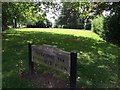
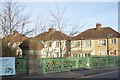

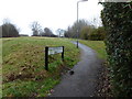
99 photos from this area
Area Information
Key information about the BS16 2AG including its size, population, and administrative classification.
- Area Type
- Postcode
- Area Size
- 11.6 hectares
- Population
- Not available
- Population Density
- Not available
House Prices in BS16 2AG
39
Properties
£281,337
Average Sold Price
£51,000
Lowest Price
£540,000
Highest Price
Showing 39 properties
| Address | Type | Beds | Baths | Last Sale Price | Last Sale Date | |
|---|---|---|---|---|---|---|
| 55 Redhill Drive, Fishponds, Bristol, BS16 2AG | Semi-detached | 3 | - | £432,000 | Nov 2024 | |
| 31 Redhill Drive, Fishponds, Bristol, BS16 2AG | house | - | - | £480,000 | Mar 2024 | |
| 45 Redhill Drive, Fishponds, Bristol, BS16 2AG | Semi-detached | 3 | 1 | £377,000 | Jun 2023 | |
| 11 Redhill Drive, Fishponds, Bristol, BS16 2AG | house | - | - | £540,000 | Jan 2022 | |
| 39 Redhill Drive, Fishponds, Bristol, BS16 2AG | house | - | - | £397,000 | Jun 2021 | |
| 47A Redhill Drive, Fishponds, Bristol, BS16 2AG | Detached | 2 | 1 | £300,000 | Dec 2020 | |
| 43 Redhill Drive, Fishponds, Bristol, BS16 2AG | house | - | - | £412,000 | Mar 2020 | |
| 53 Redhill Drive, Fishponds, Bristol, BS16 2AG | house | - | - | £505,000 | Feb 2020 | |
| 15 Redhill Drive, Fishponds, Bristol, BS16 2AG | house | - | - | £291,000 | Dec 2019 | |
| 51 Redhill Drive, Fishponds, Bristol, BS16 2AG | house | - | - | £375,000 | Jun 2019 |
Page 1 of 4
Energy Efficiency in BS16 2AG
Amenities
Schools
| Rank | School | Type | Entry gender | Ages |
|---|
Explore more schools in this area
Go to Schools tabDemographics
Household Size
One person
most common
Accommodation Type
Houses
most common
Tenure
63
majority
Ethnic Group
White
most common
Religion
N/A
most common
Household Composition
N/A
most common
Age
47
median
Adults (30-64 years)
most common
Household Deprivation
N/A
with no deprivation
NS-SEC
36
in Lower managerial occupations
Explore more demographic insights in this area
Go to Demographics tabPlanning
Planning Constraints
- Flood RiskPremium
- Ramsar Wetland SitesPremium
- Area of Outstanding Natural BeautyPremium
- Protected Nature ReservePremium
- Protected WoodlandPremium