Area Overview for BS16 1SP
Photos of BS16 1SP
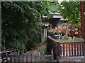
79 photos from this area
Area Information
Key information about the BS16 1SP including its size, population, and administrative classification.
- Area Type
- Postcode
- Area Size
- 6.7 hectares
- Population
- 1631
- Population Density
- 343 people/km²
House Prices in BS16 1SP
11
Properties
£455,576
Average Sold Price
£89,950
Lowest Price
£800,000
Highest Price
Showing 11 properties
| Address | Type | Beds | Baths | Last Sale Price | Last Sale Date | |
|---|---|---|---|---|---|---|
| Moorend Farm, Moorend Road, Hambrook, BS16 1SP | Land | - | - | £89,950 | Oct 2020 | |
| The Bake House, Moorend Road, Hambrook, BS16 1SP | house | 4 | - | £330,834 | Aug 2019 | |
| The Malthouse, Moorend Road, Hambrook, BS16 1SP | Semi-detached | 4 | 2 | £752,000 | Oct 2018 | |
| The Brewhouse Barn, Bury Hill, Hambrook, BS16 1SP | house | - | - | £650,000 | Dec 2015 | |
| The Elms, Bury Hill, Hambrook, BS16 1SP | Detached | 1 | 5 | £800,000 | Sep 2004 | |
| The Old Court House, Moorend Road, Hambrook, BS16 1SP | Semi-detached | - | - | £430,000 | Jan 2003 | |
| Moorend Barn, Moorend Road, Hambrook, BS16 1SP | house | - | - | £136,251 | Jan 2001 | |
| Champion House, Moorend Road, Hambrook, BS16 1SP | house | 1 | - | - | - | |
| The Old Milking Parlour, Moorend Road, Hambrook, BS16 1SP | house | - | - | - | - | |
| Riverwood Lodge, Moorend Road, Hambrook, BS16 1SP | Detached | - | - | - | - |
Page 1 of 2
Energy Efficiency in BS16 1SP
Amenities
Schools
| Rank | School | Type | Entry gender | Ages |
|---|
Explore more schools in this area
Go to Schools tabDemographics
Household Size
Family (3-5 people)
most common
Accommodation Type
Houses
most common
Tenure
68
majority
Ethnic Group
White
most common
Religion
N/A
most common
Household Composition
N/A
most common
Age
47
median
Adults (30-64 years)
most common
Household Deprivation
N/A
with no deprivation
NS-SEC
37
in Lower managerial occupations
Explore more demographic insights in this area
Go to Demographics tabPlanning
Planning Constraints
- Flood RiskPremium
- Ramsar Wetland SitesPremium
- Area of Outstanding Natural BeautyPremium
- Protected Nature ReservePremium
- Protected WoodlandPremium