Area Overview for BS16 1EP
Photos of BS16 1EP
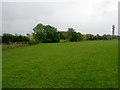

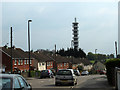
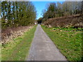

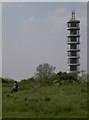
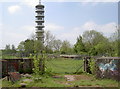
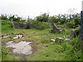
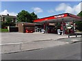
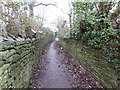
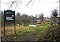
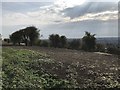
93 photos from this area
Area Information
Key information about the BS16 1EP including its size, population, and administrative classification.
- Area Type
- Postcode
- Area Size
- 1.3 hectares
- Population
- Not available
- Population Density
- Not available
House Prices in BS16 1EP
15
Properties
£234,183
Average Sold Price
£57,500
Lowest Price
£468,500
Highest Price
Showing 15 properties
| Address | Type | Beds | Baths | Last Sale Price | Last Sale Date | |
|---|---|---|---|---|---|---|
| 6 Hedgemead View, Stapleton, Bristol, BS16 1EP | Detached | 4 | 2 | £468,500 | Jan 2019 | |
| 3 Hedgemead View, Stapleton, Bristol, BS16 1EP | Semi-detached | 3 | 2 | £360,088 | Jul 2018 | |
| 8 Hedgemead View, Stapleton, Bristol, BS16 1EP | house | - | - | £360,000 | Aug 2015 | |
| 10 Hedgemead View, Stapleton, Bristol, BS16 1EP | house | - | - | £250,000 | Jan 2014 | |
| 11 Hedgemead View, Stapleton, Bristol, BS16 1EP | house | - | - | £225,000 | Nov 2012 | |
| 15 Hedgemead View, Stapleton, Bristol, BS16 1EP | house | 3 | - | £186,000 | Sep 2011 | |
| 4 Hedgemead View, Stapleton, Bristol, BS16 1EP | Semi-detached | 3 | 1 | £132,560 | Jun 2001 | |
| 13 Hedgemead View, Stapleton, Bristol, BS16 1EP | Semi-detached | - | - | £57,500 | Nov 1996 | |
| 5 Hedgemead View, Stapleton, Bristol, BS16 1EP | Semi-detached | - | - | £68,000 | Mar 1995 | |
| 1 Hedgemead View, Stapleton, Bristol, BS16 1EP | Detached | 3 | 1 | - | - |
Page 1 of 2
Energy Efficiency in BS16 1EP
Amenities
Schools
| Rank | School | Type | Entry gender | Ages |
|---|
Explore more schools in this area
Go to Schools tabDemographics
Household Size
Two person
most common
Accommodation Type
Houses
most common
Tenure
74
majority
Ethnic Group
White
most common
Religion
N/A
most common
Household Composition
N/A
most common
Age
47
median
Adults (30-64 years)
most common
Household Deprivation
N/A
with no deprivation
NS-SEC
42
in Lower managerial occupations
Explore more demographic insights in this area
Go to Demographics tabPlanning
Planning Constraints
- Flood RiskPremium
- Ramsar Wetland SitesPremium
- Area of Outstanding Natural BeautyPremium
- Protected Nature ReservePremium
- Protected WoodlandPremium