Area Overview for BS16 1AY
Photos of BS16 1AY

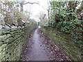
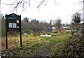
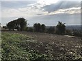
93 photos from this area
Area Information
Key information about the BS16 1AY including its size, population, and administrative classification.
- Area Type
- Postcode
- Area Size
- 3.0 hectares
- Population
- Not available
- Population Density
- Not available
House Prices in BS16 1AY
12
Properties
£300,889
Average Sold Price
£183,000
Lowest Price
£450,000
Highest Price
Showing 12 properties
| Address | Type | Beds | Baths | Last Sale Price | Last Sale Date | |
|---|---|---|---|---|---|---|
| 37 Park Road, Stapleton, Bristol, BS16 1AY | Detached | 3 | 1 | £450,000 | Feb 2020 | |
| 53 Park Road, Stapleton, Bristol, BS16 1AY | Detached | 3 | 1 | £375,000 | Dec 2019 | |
| 33 Park Road, Stapleton, Bristol, BS16 1AY | Detached | 3 | - | £350,000 | May 2017 | |
| 49 Park Road, Stapleton, Bristol, BS16 1AY | Semi-detached | 3 | - | £285,000 | Sep 2016 | |
| 41 Park Road, Stapleton, Bristol, BS16 1AY | house | - | - | £285,000 | Mar 2013 | |
| 39 Park Road, Stapleton, Bristol, BS16 1AY | Bungalow | 4 | - | £270,000 | Aug 2012 | |
| 55 Park Road, Stapleton, Bristol, BS16 1AY | Detached | 3 | 1 | £235,000 | Jul 2007 | |
| 45 Park Road, Stapleton, Bristol, BS16 1AY | Detached | - | - | £275,000 | Oct 2006 | |
| 47 Park Road, Stapleton, Bristol, BS16 1AY | Unknown | 4 | - | £183,000 | Feb 2004 | |
| 35 Park Road, Stapleton, Bristol, BS16 1AY | Detached | 3 | 2 | - | - |
Page 1 of 2
Energy Efficiency in BS16 1AY
Amenities
Schools
| Rank | School | Type | Entry gender | Ages |
|---|
Explore more schools in this area
Go to Schools tabDemographics
Household Size
Two person
most common
Accommodation Type
Houses
most common
Tenure
74
majority
Ethnic Group
White
most common
Religion
N/A
most common
Household Composition
N/A
most common
Age
47
median
Adults (30-64 years)
most common
Household Deprivation
N/A
with no deprivation
NS-SEC
42
in Lower managerial occupations
Explore more demographic insights in this area
Go to Demographics tabPlanning
Planning Constraints
- Flood RiskPremium
- Ramsar Wetland SitesPremium
- Area of Outstanding Natural BeautyPremium
- Protected Nature ReservePremium
- Protected WoodlandPremium