Area Overview for BS16 0DB
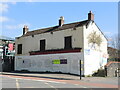
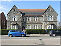
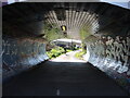
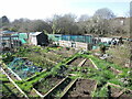
Photos of BS16 0DB
Area Information
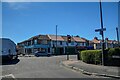
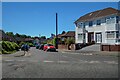
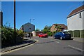
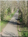
Living in BS16 0DB means being part of a small, tightly knit residential cluster in northeast Bristol, within the Frome Vale electoral ward. The area is defined by its proximity to the River Frome and the Bristol and Bath Cycle Path, offering a blend of natural and recreational access. With a population of 2,360, it is a compact community where daily life revolves around local amenities and transport links. The median age of 47 suggests a stable, established demographic, with adults aged 30–64 forming the largest group. Residents benefit from nearby schools, rail networks, and retail hubs, making it a practical choice for families and commuters. The area’s small size means a close-knit feel, though its location near major infrastructure like rail lines and the River Frome provides connectivity to broader Bristol. While not a sprawling suburb, BS16 0DB offers a quiet residential character with straightforward access to the city’s pulse.
- Area Type
- Postcode
- Area Size
- Not available
- Population
- Not available
- Population Density
- Not available
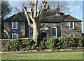
BS16 0DB is primarily an owner-occupied area, with 58% of homes owned by residents rather than rented. The accommodation type is predominantly houses, which contrasts with areas where flats or apartments dominate. This suggests a housing stock suited to families or individuals seeking more space, though the small size of the postcode means the overall property market is limited. Buyers should consider that the immediate surroundings may offer similar housing types, but the availability of new builds or larger properties is likely constrained by the area’s compact nature. The focus on owner-occupation implies a relatively stable market, though the limited number of properties could mean competition for available homes. For those prioritising space and a traditional residential layout, BS16 0DB aligns with these needs, but buyers must be prepared for a narrow selection of properties.
House Prices in BS16 0DB
No properties found in this postcode.
Energy Efficiency in BS16 0DB
The lifestyle in BS16 0DB is shaped by its proximity to retail, transport, and natural features. Within walking distance are five retail outlets, including Sainsburys Bristol, Lidl Fishponds, and Morrisons Fishponds, offering everyday shopping convenience. The area’s rail network, with stations such as Stapleton Road and Ashley Down, provides easy access to Bristol’s cultural and employment hubs. The River Frome and the Bristol and Bath Cycle Path add a recreational dimension, ideal for leisurely walks or cycling. Ferry terminals like Netham Lock and Temple Meads offer alternative routes for commuting or exploring the surrounding waterways. The nearby metro stops at Oldland and Bitton further enhance connectivity. This mix of amenities ensures a practical, accessible lifestyle, blending urban convenience with natural and transport-linked opportunities.
Amenities
Schools
Residents of BS16 0DB have access to a range of educational institutions, including the College of St Matthia’s Infant School, a primary school serving younger children. Nearby, Steiner Academy Bristol and Avanti Gardens School offer alternative educational models, with the latter holding a ‘good’ Ofsted rating. The presence of both a traditional primary school and academies provides families with options, whether they prefer established state education or the structured approach of an academy. Avanti Gardens’ positive rating suggests a reliable standard of teaching, which is a key consideration for parents. The mix of school types reflects the area’s diversity in educational provision, though the small postcode size means proximity to these institutions is a practical advantage for local families.
| Rank | School | Type | Entry gender | Ages |
|---|
Explore more schools in this area
Go to Schools tabDemographics
The community in BS16 0DB is predominantly middle-aged, with a median age of 47 and the majority of residents falling within the 30–64 age range. Home ownership stands at 58%, indicating a stable, owner-occupied demographic. The area is characterised by houses rather than flats, reflecting a traditional housing stock. The predominant ethnic group is White, though specific diversity metrics are not detailed in the data. This age profile suggests a mix of long-term residents and families, with fewer young professionals or retirees compared to other parts of Bristol. The 58% home ownership rate implies a lower proportion of rental properties, which may influence local dynamics such as community stability and property values. The absence of explicit deprivation data means quality of life factors like access to services and transport are critical to consider for prospective buyers.
Household Size
Accommodation Type
Tenure
Ethnic Group
Religion
Household Composition
Age
Household Deprivation
NS-SEC
Explore more demographic insights in this area
Go to Demographics tabPlanning
Planning Constraints
- Flood RiskPremium
- Ramsar Wetland SitesPremium
- Area of Outstanding Natural BeautyPremium
- Protected Nature ReservePremium
- Protected WoodlandPremium