Area Overview for BS15 9YL
Photos of BS15 9YL
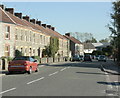
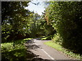
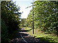
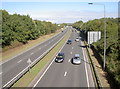
42 photos from this area
Area Information
Key information about the BS15 9YL including its size, population, and administrative classification.
- Area Type
- Postcode
- Area Size
- 6216 m²
- Population
- 1516
- Population Density
- 5592 people/km²
House Prices in BS15 9YL
21
Properties
£188,444
Average Sold Price
£43,000
Lowest Price
£295,000
Highest Price
Showing 21 properties
| Address | Type | Beds | Baths | Last Sale Price | Last Sale Date | |
|---|---|---|---|---|---|---|
| 7 Whitecroft Way, Kingswood, BS15 9YL | Terraced | 3 | 1 | £295,000 | Feb 2023 | |
| 41 Whitecroft Way, Kingswood, BS15 9YL | Semi-detached | 3 | 1 | £220,000 | Jul 2019 | |
| 23 Whitecroft Way, Kingswood, BS15 9YL | Semi-detached | 3 | 1 | £215,000 | Jun 2019 | |
| 19 Whitecroft Way, Kingswood, BS15 9YL | Semi-detached | 4 | 2 | £265,000 | Feb 2019 | |
| 5 Whitecroft Way, Kingswood, BS15 9YL | Terraced | 3 | 1 | £205,000 | Jul 2017 | |
| 35 Whitecroft Way, Kingswood, BS15 9YL | house | - | - | £168,000 | Jul 2015 | |
| 1 Whitecroft Way, Kingswood, BS15 9YL | house | - | - | £155,000 | Mar 2010 | |
| 33 Whitecroft Way, Kingswood, BS15 9YL | Semi-detached | 3 | 1 | £130,000 | Dec 2002 | |
| 9 Whitecroft Way, Kingswood, BS15 9YL | Terraced | - | - | £43,000 | Feb 1996 | |
| 11 Whitecroft Way, Kingswood, BS15 9YL | Semi-detached | 3 | 1 | - | - |
Page 1 of 3
Energy Efficiency in BS15 9YL
Amenities
Schools
| Rank | School | Type | Entry gender | Ages |
|---|
Explore more schools in this area
Go to Schools tabDemographics
Household Size
Two person
most common
Accommodation Type
Houses
most common
Tenure
75
majority
Ethnic Group
White
most common
Religion
N/A
most common
Household Composition
N/A
most common
Age
47
median
Adults (30-64 years)
most common
Household Deprivation
N/A
with no deprivation
NS-SEC
29
in Lower managerial occupations
Explore more demographic insights in this area
Go to Demographics tabPlanning
Planning Constraints
- Flood RiskPremium
- Ramsar Wetland SitesPremium
- Area of Outstanding Natural BeautyPremium
- Protected Nature ReservePremium
- Protected WoodlandPremium