Area Overview for BS15 9XE
Photos of BS15 9XE
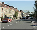
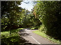
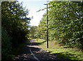
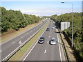
42 photos from this area
Area Information
Key information about the BS15 9XE including its size, population, and administrative classification.
- Area Type
- Postcode
- Area Size
- 4.9 hectares
- Population
- 1516
- Population Density
- 5592 people/km²
House Prices in BS15 9XE
29
Properties
£248,175
Average Sold Price
£44,000
Lowest Price
£435,000
Highest Price
Showing 29 properties
| Address | Type | Beds | Baths | Last Sale Price | Last Sale Date | |
|---|---|---|---|---|---|---|
| 85 Baden Road, Kingswood, BS15 9XE | Terraced | 3 | 1 | £322,500 | Oct 2025 | |
| 61 Baden Road, Kingswood, BS15 9XE | Terraced | 3 | 1 | £282,000 | Jan 2024 | |
| 68 Baden Road, Kingswood, BS15 9XE | Bungalow | 2 | 1 | £373,000 | May 2023 | |
| 81 Baden Road, Kingswood, BS15 9XE | Terraced | 4 | 3 | £435,000 | Dec 2022 | |
| 93 Baden Road, Kingswood, BS15 9XE | Terraced | 4 | 2 | £360,000 | Jun 2021 | |
| 91 Baden Road, Kingswood, BS15 9XE | house | - | - | £310,000 | Jun 2021 | |
| 67 Baden Road, Kingswood, BS15 9XE | Terraced | 3 | 1 | £240,000 | Sep 2018 | |
| 99 Baden Road, Kingswood, BS15 9XE | house | - | - | £327,000 | Feb 2017 | |
| 75 Baden Road, Kingswood, BS15 9XE | Terraced | 3 | 1 | £210,000 | Aug 2016 | |
| 53 Baden Road, Kingswood, BS15 9XE | Terraced | 3 | 1 | £181,500 | Nov 2013 |
Page 1 of 3
Energy Efficiency in BS15 9XE
Amenities
Schools
| Rank | School | Type | Entry gender | Ages |
|---|
Explore more schools in this area
Go to Schools tabDemographics
Household Size
Two person
most common
Accommodation Type
Houses
most common
Tenure
75
majority
Ethnic Group
White
most common
Religion
N/A
most common
Household Composition
N/A
most common
Age
47
median
Adults (30-64 years)
most common
Household Deprivation
N/A
with no deprivation
NS-SEC
29
in Lower managerial occupations
Explore more demographic insights in this area
Go to Demographics tabPlanning
Planning Constraints
- Flood RiskPremium
- Ramsar Wetland SitesPremium
- Area of Outstanding Natural BeautyPremium
- Protected Nature ReservePremium
- Protected WoodlandPremium