Area Overview for BS15 8BP
Photos of BS15 8BP
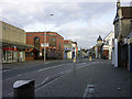
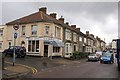
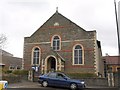
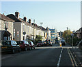
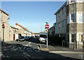
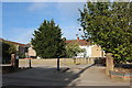

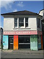
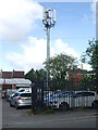
83 photos from this area
Area Information
Key information about the BS15 8BP including its size, population, and administrative classification.
- Area Type
- Postcode
- Area Size
- 1.2 hectares
- Population
- 1866
- Population Density
- 8238 people/km²
House Prices in BS15 8BP
35
Properties
£206,225
Average Sold Price
£40,000
Lowest Price
£395,000
Highest Price
Showing 35 properties
| Address | Type | Beds | Baths | Last Sale Price | Last Sale Date | |
|---|---|---|---|---|---|---|
| 15 Hillside Avenue, St George, Bristol, BS15 8BP | Terraced | 3 | - | £395,000 | Oct 2023 | |
| 53 Hillside Avenue, St George, Bristol, BS15 8BP | Terraced | 3 | 1 | £330,000 | Oct 2022 | |
| 61 Hillside Avenue, St George, Bristol, BS15 8BP | house | 3 | - | £267,000 | Aug 2021 | |
| 63 Hillside Avenue, St George, Bristol, BS15 8BP | Terraced | 4 | - | £330,000 | Feb 2021 | |
| 69 Hillside Avenue, St George, Bristol, BS15 8BP | Terraced | 3 | 1 | £255,000 | Sep 2020 | |
| 7 Hillside Avenue, St George, Bristol, BS15 8BP | Terraced | 3 | 1 | £270,000 | Sep 2020 | |
| 49 Hillside Avenue, St George, Bristol, BS15 8BP | Terraced | 3 | 2 | £272,000 | Jun 2019 | |
| 41 Hillside Avenue, St George, Bristol, BS15 8BP | house | 3 | 1 | £260,000 | Sep 2018 | |
| 55 Hillside Avenue, St George, Bristol, BS15 8BP | Terraced | 3 | - | £210,000 | Jan 2016 | |
| 9 Hillside Avenue, St George, Bristol, BS15 8BP | Terraced | 3 | - | £194,000 | Oct 2015 |
Page 1 of 4
Energy Efficiency in BS15 8BP
Amenities
Schools
| Rank | School | Type | Entry gender | Ages |
|---|
Explore more schools in this area
Go to Schools tabDemographics
Household Size
One person
most common
Accommodation Type
Houses
most common
Tenure
57
majority
Ethnic Group
White
most common
Religion
N/A
most common
Household Composition
N/A
most common
Age
47
median
Adults (30-64 years)
most common
Household Deprivation
N/A
with no deprivation
NS-SEC
30
in Lower managerial occupations
Explore more demographic insights in this area
Go to Demographics tabPlanning
Planning Constraints
- Flood RiskPremium
- Ramsar Wetland SitesPremium
- Area of Outstanding Natural BeautyPremium
- Protected Nature ReservePremium
- Protected WoodlandPremium