Area Overview for BS15 6RW
Photos of BS15 6RW


Area Information
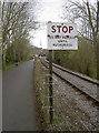
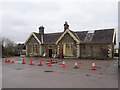
BS15 6RW is a small residential postcode area nestled in the village of Bitton, South Gloucestershire. With a population of just 1,550, it reflects the quiet, close-knit character of this rural parish. The area is part of a broader cluster that includes nearby villages such as Oldland and Swineford, all situated along the River Boyd, east of Bristol. Daily life here is shaped by its proximity to both natural and historical landmarks, including St Mary’s Church and the Avon Valley Railway. The community is predominantly composed of adults aged 30–64, with a median age of 47, suggesting a stable, family-oriented demographic. Homeownership is high at 87%, indicating a strong local presence. While the area lacks large urban amenities, its small size and low population density offer a peaceful, low-traffic environment. Residents benefit from nearby transport links, including multiple railway stations and ferry terminals, which connect them to Bristol and Bath. The area’s charm lies in its blend of historical heritage and modern convenience, making it appealing to those seeking a slower pace of life without sacrificing accessibility.
- Area Type
- Postcode
- Area Size
- Not available
- Population
- 1550
- Population Density
- 2742 people/km²
The property market in BS15 6RW is characterised by high home ownership (87%) and a predominance of houses rather than flats or apartments. This suggests a suburban or rural housing stock, with larger properties that cater to families or individuals seeking space. The small population and low density of the area mean that the market is likely limited to a few properties, with limited scope for new developments. For buyers, this presents a niche opportunity: the area is not a rental hotspot but rather a place where residents are likely to stay long-term. The high ownership rate indicates that properties here may hold value over time, though the small size of the area means that buyers should consider the broader surrounding villages, such as Bitton and Oldland, for more options. The focus on houses also means that buyers should look for properties with gardens or outdoor space, which are more common in rural settings. The market is not heavily influenced by speculative investment, making it a stable but low-volume area for property transactions.
House Prices in BS15 6RW
No properties found in this postcode.
Energy Efficiency in BS15 6RW
Living in BS15 6RW offers access to a range of nearby amenities, including retail, transport, and leisure options. The area is within practical reach of five retail outlets, such as Morrisons Daily, Tesco Longwell, and Aldi Longwell, providing everyday shopping convenience. For transport, residents can utilise five railway stations, including Keynsham and Stapleton Road, as well as ferry terminals like Netham Lock and Temple Meads. These links connect the area to Bristol and Bath, facilitating both commuting and leisure travel. The A431 road and multiple bus routes further enhance mobility. While the area itself is small, the surrounding villages of Bitton and Oldland offer additional facilities, including the Avon Valley Railway and the National Cycle Network’s Bristol and Bath Railway Path. The nearby St Mary’s Church and historical sites contribute to a sense of local heritage. The combination of retail, transport, and recreational options ensures that daily life in BS15 6RW is both practical and connected to broader regional networks.
Amenities
Schools
The nearest school to BS15 6RW is Cherry Garden Primary School, which serves the local community with primary education. The data does not provide an Ofsted rating, but the presence of a primary school within the area suggests that families with young children have access to localised education. As a primary school, it caters to the needs of younger students, though secondary education options would require travel to nearby towns such as Keynsham or Willsbridge. The single primary school listed indicates that the area’s educational infrastructure is modest, relying on nearby towns for more comprehensive schooling. For families prioritising proximity to schools, this may be a consideration, though the small population of the area means that the school likely serves a broader catchment beyond BS15 6RW. The lack of additional schools in the data suggests that the area is not a major hub for education, but the existing school provides a foundational service for local children.
| Rank | School | Type | Entry gender | Ages |
|---|
Explore more schools in this area
Go to Schools tabDemographics
The community in BS15 6RW is predominantly composed of adults aged 30–64, with a median age of 47. This suggests a mature, established population, likely with long-term ties to the area. Homeownership is exceptionally high at 87%, indicating that most residents are long-term residents rather than renters. The accommodation types here are primarily houses, reflecting a suburban or rural setting with larger properties. The predominant ethnic group is White, which aligns with the broader demographic trends in South Gloucestershire. While the data does not specify deprivation levels, the high home ownership and low population density suggest a relatively stable economic profile. The absence of significant diversity metrics means the community is homogenous in composition. This demographic profile implies a neighbourhood where families and older residents coexist, with limited transient populations. The age range and ownership figures suggest a community that values stability, with fewer young families or students compared to urban areas.
Household Size
Accommodation Type
Tenure
Ethnic Group
Religion
Household Composition
Age
Household Deprivation
NS-SEC
Explore more demographic insights in this area
Go to Demographics tabPlanning
Planning Constraints
- Flood RiskPremium
- Ramsar Wetland SitesPremium
- Area of Outstanding Natural BeautyPremium
- Protected Nature ReservePremium
- Protected WoodlandPremium