Area Overview for BS15 6AW
Photos of BS15 6AW


Area Information
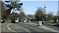
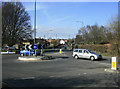
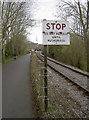
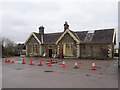
BS15 6AW lies within the small residential cluster of Bitton, a village in South Gloucestershire, England. With a population of 2,167 and a density of 195 people per square kilometre, this area balances quiet village life with proximity to Bristol. Bitton’s history is steeped in medieval roots, with St Mary’s Church dating to Edward the Confessor’s era and a network of historic churches across the parish. The area’s charm lies in its compact size, offering a close-knit community feel while remaining within reach of major transport routes. Residents benefit from the A431 road, which links to Willsbridge and Kelston, and multiple railway stations, including Keynsham and Stapleton Road, providing easy access to Bristol and Bath. Nearby, the Avon Valley Railway and National Cycle Network offer recreational routes. The area’s blend of heritage and practical connectivity makes it appealing for those seeking a stable, low-maintenance lifestyle without sacrificing access to urban amenities.
- Area Type
- Postcode
- Area Size
- Not available
- Population
- 2167
- Population Density
- 195 people/km²
The property market in BS15 6AW is characterised by high home ownership (71%) and a focus on houses, which are the predominant accommodation type. This suggests a market skewed towards owner-occupation rather than rental properties, likely due to the area’s semi-rural setting and limited high-density housing. The small population and compact size of the postcode mean the housing stock is limited, which could lead to competitive demand for available properties. Buyers should consider that the area’s appeal lies in its tranquillity and proximity to transport links, making it attractive to professionals working in nearby cities like Bristol. However, the small scale of the area may limit options for first-time buyers or those seeking larger properties. The lack of commercial or industrial land use ensures the area remains residential, preserving its character but potentially restricting development.
House Prices in BS15 6AW
No properties found in this postcode.
Energy Efficiency in BS15 6AW
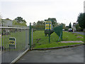
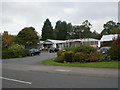
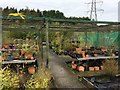
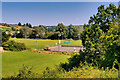
Living in BS15 6AW offers a mix of practical amenities and village character. Within walking distance are five retail stores, including Morrisons Daily, Tesco Longwell, and Aldi Longwell, providing everyday shopping needs. The area’s transport links ensure access to larger urban centres, while the A431 road and multiple railway stations facilitate travel. Recreational options include the Avon Valley Railway heritage line and the Bristol and Bath Railway Path, ideal for cycling or walking. The nearby Recreation Ground hosts local sports clubs like Bitton A.F.C. and Bitton CC, fostering community engagement. The village’s historical sites, such as St Mary’s Church with its Norman elements, add cultural depth. While the area lacks large-scale leisure facilities, its compact size ensures a sense of cohesion, with amenities designed for convenience rather than grandeur.
Amenities
Schools
The schools nearest to BS15 6AW include The Meadows Primary School, a state-funded primary school with an Ofsted rating of ‘good’, and Focus School – Berkeley Primary Campus, an independent primary school. The presence of both state and independent options provides families with choices tailored to their preferences, whether prioritising affordability or specialist education. The Meadows Primary’s ‘good’ rating indicates a school delivering consistent standards in teaching and outcomes, which is reassuring for parents. However, the data does not specify secondary schools or higher education institutions nearby, so families may need to look beyond the immediate area for comprehensive schooling. The mix of school types reflects the area’s diversity in educational provision, though the absence of data on school capacity or catchment areas means potential challenges for enrolling children could not be assessed.
| Rank | School | Type | Entry gender | Ages |
|---|
Explore more schools in this area
Go to Schools tabDemographics
The population of BS15 6AW is predominantly adults aged 30–64, with a median age of 47. This suggests a mature, established community, likely with families and professionals seeking stability. Home ownership is high at 71%, indicating a strong presence of long-term residents. The accommodation type is primarily houses, reflecting a suburban or semi-rural character. The predominant ethnic group is White, with no data provided on other demographics. The age profile and ownership rates suggest a low turnover of properties, which can stabilise local property values. However, the lack of diversity data means the area’s cultural composition remains unexplored in this context. The absence of specific deprivation metrics means the quality of life cannot be assessed in terms of socioeconomic challenges, but the low crime score of 73/100 implies a generally secure environment.
Household Size
Accommodation Type
Tenure
Ethnic Group
Religion
Household Composition
Age
Household Deprivation
NS-SEC
Explore more demographic insights in this area
Go to Demographics tabPlanning
Planning Constraints
- Flood RiskPremium
- Ramsar Wetland SitesPremium
- Area of Outstanding Natural BeautyPremium
- Protected Nature ReservePremium
- Protected WoodlandPremium