Area Overview for BS15 5SQ
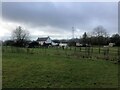
Photos of BS15 5SQ


Area Information
Living in BS15 5SQ places you in a small residential cluster within South Gloucestershire, near Bristol. The area has a population of 1,323, with a high density of 1,087 people per square kilometre, reflecting its compact nature. This postcode sits within the parish of Bitton, a village known for its historical roots and proximity to the River Boyd. Daily life here is shaped by its rural character, with a focus on community and local amenities. The area is surrounded by nearby villages such as Oldland and Swineford, offering a blend of traditional charm and practical connectivity. With a median age of 47 and a strong presence of adults aged 30–64, the community is stable and family-oriented. Home ownership is high at 88%, with most properties being houses, indicating a residential, low-density environment. The area’s proximity to transport networks and amenities makes it accessible for commuters while retaining a village feel.
- Area Type
- Postcode
- Area Size
- Not available
- Population
- 1323
- Population Density
- 1087 people/km²
The property market in BS15 5SQ is dominated by owner-occupied homes, with 88% of properties owned by residents rather than rented. This high home ownership rate suggests a stable, long-term community with limited turnover. The accommodation type is predominantly houses, indicating a lack of high-rise or apartment-style housing. As a small postcode area, the housing stock is limited, which may make the market competitive for buyers. The area’s proximity to nearby villages like Oldland and Bitton offers potential for expansion, but within BS15 5SQ itself, the focus is on single-family homes. Buyers should consider the compact nature of the area, which may mean fewer options for larger properties or development. The high home ownership rate also implies a strong local economy, with residents less likely to move frequently.
House Prices in BS15 5SQ
No properties found in this postcode.
Energy Efficiency in BS15 5SQ
The lifestyle in BS15 5SQ is shaped by its proximity to a range of amenities. Local shops such as Budgens Longwell and Morrisons Daily provide essential goods, while The Southern Co-operative Co offers additional retail options. The area’s transport links include multiple railway stations and ferry terminals, facilitating easy access to nearby towns and cities. For leisure, the A431 road connects to the National Cycle Network’s Bristol and Bath Railway Path, offering opportunities for cycling or walking. The parish of Bitton itself has historical sites like St Mary’s Church and the Avon Valley Railway, adding cultural and recreational value. The presence of nearby villages like Oldland and Swineford also means residents can access more extensive amenities without leaving the area. This combination of practical retail, transport, and recreational options creates a convenient, well-connected lifestyle.
Amenities
Schools
The nearest schools to BS15 5SQ include Redfield Edge Primary School, which serves the local community. This primary school is listed twice in the data, though it is likely a single institution. The absence of secondary schools in the immediate vicinity means families may need to consider commuting to nearby towns for secondary education. The presence of a primary school indicates a focus on early education, which is beneficial for families with young children. However, the data does not provide Ofsted ratings or additional details about the school’s performance. Parents should investigate further to understand the quality of education available, though the availability of a primary school is a clear advantage for young families.
| Rank | School | Type | Entry gender | Ages |
|---|
Explore more schools in this area
Go to Schools tabDemographics
The community in BS15 5SQ is predominantly composed of adults aged 30–64, with a median age of 47. This suggests a mature population, likely settled in long-term homes, with a strong presence of middle-aged households. Home ownership is exceptionally high at 88%, reflecting a stable residential market with few rental properties. The accommodation type is primarily houses, indicating a lack of high-density housing such as flats or apartments. The predominant ethnic group is White, with no specific data on other demographics provided. The population density of 1,087 people per square kilometre is notable for a small postcode, suggesting a tightly knit community. This density, combined with high home ownership, implies a focus on private, family-oriented living rather than transient or rental-based populations.
Household Size
Accommodation Type
Tenure
Ethnic Group
Religion
Household Composition
Age
Household Deprivation
NS-SEC
Explore more demographic insights in this area
Go to Demographics tabPlanning
Planning Constraints
- Flood RiskPremium
- Ramsar Wetland SitesPremium
- Area of Outstanding Natural BeautyPremium
- Protected Nature ReservePremium
- Protected WoodlandPremium