Area Overview for BS15 2XT
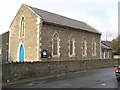
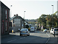
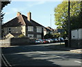
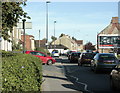
Photos of BS15 2XT
Area Information
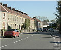
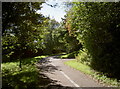
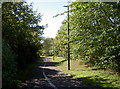
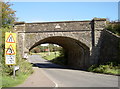
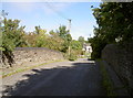
Living in BS15 2XT means being part of a small, tightly knit residential cluster in South Gloucestershire. With a population of 1,706 and a density of 1,017 people per square kilometre, this area balances rural charm with accessible amenities. Centred around Siston Brook and the historic parish church of St Anne, the village retains its medieval character, bordered by the Royal Hunting Forest of Kingswood. The mix of cottages, farms, and the Tudor manor house Siston Court reflects centuries of agricultural and aristocratic heritage. Nearby, the Warmley Giant statue and Kingswood Heritage Museum hint at the region’s industrial and cultural legacy. Residents benefit from proximity to both natural landscapes and practical infrastructure, making it a quiet yet connected place to live. The area’s compact size ensures a strong sense of community, with local landmarks like Warmley Green war memorial and Warmley Brass Works adding layers of history to daily life.
- Area Type
- Postcode
- Area Size
- Not available
- Population
- 1706
- Population Density
- 1017 people/km²
BS15 2XT is an owner-occupied area, with 81% of homes owned by residents rather than rented. The accommodation type is predominantly houses, which is typical for smaller rural or semi-rural clusters. This suggests a housing stock that prioritises private, standalone properties over flats or shared developments. The small size of the area means the property market is limited in scale, with fewer options but potentially higher demand from buyers seeking a quiet, established community. The high home ownership rate indicates long-term residency, which can stabilise property values. For buyers, this means a focus on individual homes rather than investment in rental portfolios. Proximity to nearby towns like Keynsham and the availability of rail links may also influence property desirability, though the area’s compact nature means it is best suited for those prioritising a close-knit, low-traffic environment.
House Prices in BS15 2XT
No properties found in this postcode.
Energy Efficiency in BS15 2XT
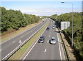
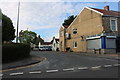
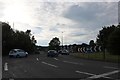
The lifestyle in BS15 2XT is shaped by its proximity to shops, transport hubs, and historical sites. Local retail options include Tesco Warmley Deanery, Budgens Longwell, and The Southern Co-operative, offering everyday essentials within reach. Rail and ferry connections to Bristol and surrounding areas facilitate commuting or leisure trips. The area’s heritage is evident in landmarks like the Norman St Anne church, Siston Court, and the Warmley Giant statue, blending history with modern convenience. Parks and open spaces, though not explicitly named, are implied by the nearby Siston Brook and the surrounding forested areas. This combination of practical amenities and cultural richness creates a balanced lifestyle, where residents can enjoy both the tranquillity of rural living and the accessibility of urban networks.
Amenities
Schools
The schools nearest to BS15 2XT include Warmley Tower School and Warmley Park School, both designated as special schools. These institutions cater to students with specific educational needs, reflecting the area’s focus on tailored support for learners. While no Ofsted ratings are provided, the presence of two special schools suggests a strong local commitment to inclusive education. For families requiring such provisions, this area offers direct access to dedicated resources. However, the absence of mainstream primary or secondary schools in the immediate vicinity may necessitate commuting to nearby towns for broader educational options. The mix of school types indicates a community that values accessibility for all students, though it is important to consider the practical implications for households without specific needs.
| Rank | School | Type | Entry gender | Ages |
|---|
Explore more schools in this area
Go to Schools tabDemographics
The community in BS15 2XT is predominantly composed of adults aged 30–64, with a median age of 47. This suggests a mature population, likely with established careers and families. Home ownership is high at 81%, indicating a stable, long-term resident base. The accommodation type is primarily houses, reflecting a more traditional housing stock compared to flats or apartments. The predominant ethnic group is White, though the data does not specify further diversity metrics. The low population density and high home ownership rate suggest a low-deprivation environment, where residents may enjoy greater privacy and fewer pressures of urban living. This profile aligns with a community focused on comfort, continuity, and proximity to local amenities rather than rapid change or high-density development.
Household Size
Accommodation Type
Tenure
Ethnic Group
Religion
Household Composition
Age
Household Deprivation
NS-SEC
Explore more demographic insights in this area
Go to Demographics tabPlanning
Planning Constraints
- Flood RiskPremium
- Ramsar Wetland SitesPremium
- Area of Outstanding Natural BeautyPremium
- Protected Nature ReservePremium
- Protected WoodlandPremium