Area Overview for BS15 2LD
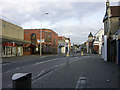
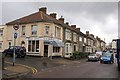
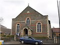
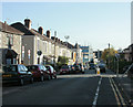
Photos of BS15 2LD
Area Information
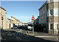
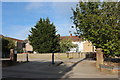
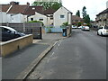
BS15 2LD is a small residential cluster in South Gloucestershire, nestled approximately 3½ miles northeast of Bristol. With a population of 1,976, it retains a suburban character shaped by its historical roots as a royal forest and 18th-century Methodist hub. The area’s proximity to the Bristol and Gloucester railway, along with nearby stations like Stapleton Road and Keynsham, connects it to regional transport networks. Today, it balances its heritage with modern amenities, including retail outlets like Iceland Kingswood and Sainsburys, and access to Bristol Filton Airport. The community is defined by its older housing stock, with a focus on family homes and a median age of 47, suggesting a stable, established population. While historically tied to industries like coal mining and shoe-making, the local economy now supports printing and light engineering. Its mix of historical sites, such as the 19th-century church with a 90-foot tower, and practical infrastructure makes it a distinctive choice for those seeking a quiet yet connected lifestyle.
- Area Type
- Postcode
- Area Size
- Not available
- Population
- Not available
- Population Density
- Not available
BS15 2LD is primarily a residential area with a focus on houses, reflecting its suburban character. Home ownership is at 57%, indicating a moderate mix of owner-occupied properties and rental units. Given the small size of the postcode and its proximity to Bristol, property availability is likely limited, with buyers needing to consider nearby areas for more options. The predominance of houses over flats or apartments suggests a traditional, family-friendly housing stock. However, the lack of specific data on property prices or recent market trends means buyers must rely on local agents for up-to-date insights. The area’s historical ties to collieries and its current industrial mix may influence property values, but without concrete figures, this remains speculative.
House Prices in BS15 2LD
No properties found in this postcode.
Energy Efficiency in BS15 2LD
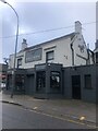
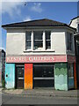
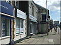
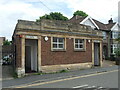
Residents of BS15 2LD have access to a range of amenities within practical reach. Retail options include Iceland Kingswood, Sainsburys Kingswood, and Lidl Kingswood, offering everyday shopping needs. The area’s proximity to ferry terminals like Netham Lock and Temple Meads, along with rail stations such as Keynsham and Stapleton Road, ensures easy travel for commuters. Historical sites, such as the 19th-century church with its 90-foot tower, add cultural value. The presence of a primary school and nearby industrial hubs like printing and engineering firms provide a mix of practicality and heritage. While the area lacks large leisure facilities, its suburban layout and transport links to Bristol balance convenience with a quieter lifestyle.
Amenities
Schools
The primary school nearest to BS15 2LD is The Park Primary School, though no Ofsted rating is provided in the data. The presence of a primary school indicates the area’s suitability for families with young children, though the absence of secondary schools or additional educational institutions means parents may need to travel to nearby towns for higher education. The duplication of The Park Primary School in the data may reflect an error, but the single listing suggests a focus on primary education. Families seeking a comprehensive school network may need to look beyond the immediate postcode, as no secondary schools are named.
| Rank | School | Type | Entry gender | Ages |
|---|
Explore more schools in this area
Go to Schools tabDemographics
The population of BS15 2LD is 1,976, with a median age of 47, indicating a community skewed towards middle-aged adults. The most common age range is 30–64 years, reflecting a stable, working-age population. Home ownership stands at 57%, with houses being the predominant accommodation type. This suggests a mix of owner-occupied properties and rental stock, though the exact proportion of renters is not specified. The predominant ethnic group is White, though no further breakdown of diversity is provided. The age profile and home ownership rates imply a settled, family-oriented demographic. However, the lack of specific data on deprivation or income levels means the area’s economic resilience cannot be fully assessed. The absence of detailed diversity metrics also limits understanding of cultural or social dynamics.
Household Size
Accommodation Type
Tenure
Ethnic Group
Religion
Household Composition
Age
Household Deprivation
NS-SEC
Explore more demographic insights in this area
Go to Demographics tabPlanning
Planning Constraints
- Flood RiskPremium
- Ramsar Wetland SitesPremium
- Area of Outstanding Natural BeautyPremium
- Protected Nature ReservePremium
- Protected WoodlandPremium