Area Overview for BS15 1AX
Photos of BS15 1AX
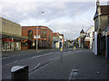
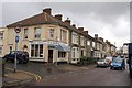

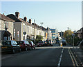
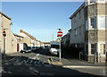
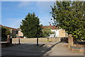

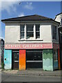
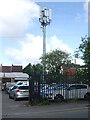
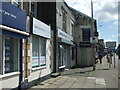
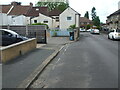
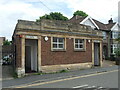
83 photos from this area
Area Information
Key information about the BS15 1AX including its size, population, and administrative classification.
- Area Type
- Postcode
- Area Size
- 2822 m²
- Population
- 1866
- Population Density
- 8238 people/km²
House Prices in BS15 1AX
14
Properties
-
Average Sold Price
-
Lowest Price
-
Highest Price
Showing 14 properties
| Address | Type | Beds | Baths | Last Sale Price | Last Sale Date | |
|---|---|---|---|---|---|---|
| 267B Two Mile Hill Road, St George, Bristol, BS15 1AX | Flat | - | - | - | - | |
| Eastern Spices, 269 Two Mile Hill Road, St George, Bristol, BS15 1AX | restaurant_cafe | - | - | - | - | |
| Jades Palace, 275-277 Two Mile Hill Road, St George, Bristol, BS15 1AX | restaurant_cafe | - | - | - | - | |
| 267A Two Mile Hill Road, St George, Bristol, BS15 1AX | Flat | - | - | - | - | |
| 273 Two Mile Hill Road, St George, Bristol, BS15 1AX | office_workshop | - | - | - | - | |
| Advanced Automotive Performance Ltd, 271 Two Mile Hill Road, St George, Bristol, BS15 1AX | retail_financial | - | - | - | - | |
| First Floor Flat, 275 Two Mile Hill Road, St George, Bristol, BS15 1AX | Flat | - | - | - | - | |
| Flat 1, 273 Two Mile Hill Road, St George, Bristol, BS15 1AX | Flat | 2 | 1 | - | - | |
| Flat, 277 Two Mile Hill Road, St George, Bristol, BS15 1AX | Flat | - | - | - | - | |
| Flat, 265 Two Mile Hill Road, St George, Bristol, BS15 1AX | Flat | 3 | 2 | - | - |
Page 1 of 2
Energy Efficiency in BS15 1AX
Amenities
Schools
| Rank | School | Type | Entry gender | Ages |
|---|
Explore more schools in this area
Go to Schools tabDemographics
Household Size
One person
most common
Accommodation Type
Houses
most common
Tenure
57
majority
Ethnic Group
White
most common
Religion
N/A
most common
Household Composition
N/A
most common
Age
47
median
Adults (30-64 years)
most common
Household Deprivation
N/A
with no deprivation
NS-SEC
30
in Lower managerial occupations
Explore more demographic insights in this area
Go to Demographics tabPlanning
Planning Constraints
- Flood RiskPremium
- Ramsar Wetland SitesPremium
- Area of Outstanding Natural BeautyPremium
- Protected Nature ReservePremium
- Protected WoodlandPremium